CASEI: The Catalog of Suborbital Earth science Investigations
For more than 50 years, NASA has collected airborne and field data during field campaigns applicable to many science disciplines, including meteorology, hydrology, oceanography, and terrestrial studies. Data collected from these campaigns have been stored in various locations making them difficult to locate and access.
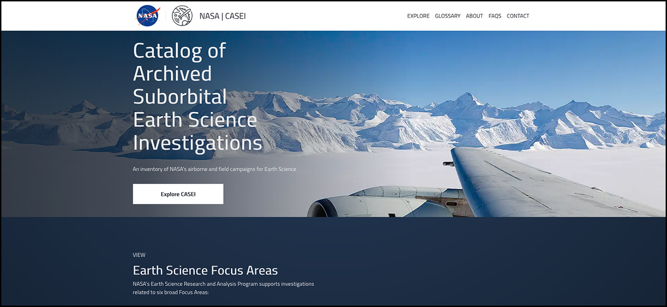
To improve the discoverability and accessibility of NASA campaign data, the Airborne Data Management Group (ADMG) is building a detailed airborne and field inventory called the Catalog of Archived Suborbital Earth Science Investigations (CASEI).
CASEI provides information about NASA campaigns, platforms, instruments, data products, and other contextual details needed for future data use. CASEI is built upon a carefully designed metadata model that is based upon formalized definitions. Inventory curators use decision trees to ensure consistent decisions are made in placing the metadata into the inventory. This ensures good organization and clear communication of the variety of airborne and field campaign metadata.
The CASEI interface allows users to easily learn about, locate, access, and utilize airborne and field data for scientific research, applications, and decision making. The highly interlinked information makes it easy to explore across all contents. An API is available for more advanced users to access the inventory database contents.
Why is CASEI needed?
The dispersed nature of existing NASA airborne and field data requires one central location for data discovery with an interface designed to meet the needs of various types of airborne data users. CASEI was developed as a centralized location for data discovery. Users need to search for airborne and field data by parameters or variables such as location and time frame, flight track information, relevant publications about the campaigns, and instrumentation details.
What does CASEI do?
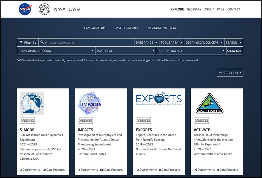
Users can access details of existing, past, and upcoming NASA airborne and field campaigns. Users can also search for the data from campaigns and instruments using multiple parameters such as date range, geographical region, science focus area, or platform. Once users have identified the airborne and field data they need, they are directed to data product landing pages where they can download and access data from the appropriate DAAC.
Where can you explore CASEI?
CASEI was launched in June 2021 and is now available to the public. CASEI is currently in a Beta version with only about 50% of campaign, instrument, and platform metadata. The ADMG curators continue to add more content and design new CASEI features.
How can you help?
Contact ADMG with any feedback or questions about CASEI at admg@uah.edu. Knowledge of what users want from CASEI will help us to better plan for and provide future improvements.
Additional Resources
Here are additional sources for finding information about NASA airborne and field campaigns.
- NASA Airborne and Field Investigations Categories or Data Types: contains information about the categories or different types of airborne and field campaigns within CASEI.
- Airborne Science Program: contains airborne campaign information and resources.
- Earthdata Search: can locate airborne and field data available at any of the NASA DAACs.
- NASA Earth Missions List: specific campaigns can be located by topic; not all campaigns are listed, only those with mission or program status.
- NASA Airborne and Field Data Workshop: contains recordings and presentations from the NASA Airborne and Field Data Workshop. Also has links to articles and the final report of workshop findings and recommendations.
- Available DAAC Tools and Services
-
The following tools and services can be used to discover, explore, or use NASA airborne and field data:
Tool Type Tool Name Description Available Campaigns Search and Data Access Earthdata Search General search tool for locating NASA Earth science data using filters; filter by organization to locate data at a specific DAAC
All public campaign data in NASA's Earth Observing System Data and Information System (EOSDIS) Search and Data Access Suborbital Data Portal A specialized Earthdata Search portal for airborne and field data product discovery Most public campaign data products published at DAACs Discover and Learn, Data Access CASEI A catalog of NASA airborne and field campaigns/projects;
currently has roughly 45% of known campaignsContextual metadata for 70+ airborne and field campaigns Visualize Spatial Data Access Tool (SDAT) Visualize and download select data using Open Geospatial Consortium (OGC) standards; available through NASA's Oak Ridge National Laboratory DAAC (ORNL DAAC) Arctic Boreal Vulnerability Experiment (ABoVE), Africa Synthetic Aperture Radar (AfriSAR), Carbon in Arctic Reservoirs Vulnerability Experiment (CARVE), Large-Scale Biosphere-Atmosphere Experiment in Amazonia (LBA) Visualize Soil Moisture Visualizer Subset, view, and download harmonized Soil Moisture data from various projects; available through ORNL DAAC Airborne Microwave Observatory of Subcanopy and Subsurface (AirMOSS), Soil moisture Sensing Controller and oPtimal Estimator (SoilSCAPE), Snow Telemetry Network (SNOTEL), Flux Network (FLUXNET) Visualize Airborne Data Visualizer (ADV) Visualize airborne campaign flight track measurements; available through ORNL DAAC Atmospheric Carbon and Transport-America (ACT-America), Atmospheric Tomography Mission (ATom), CARVE Discover and Learn Atmospheric Science Data Center (ASDC) Project Catalog and Explore Collections Tool Online access providing a means to explore data collections at ASDC and review description of all projects All campaign data available through ASDC Search and Data Access Sub-Orbital Order Tool (SOOT) Power User Interface Search for data files from specific campaigns at ASDC and download the data; only Power User Interface is currently available Aerosol Characterization from Polarimeter and Lidar (ACEPOL), Arctic Radiation - IceBridge Sea & Ice Experiment (ARISE), Clouds, Aerosol and Monsoon Processes-Philippines Experiment (CAMP2Ex), Fire Influence on Regional to Global Environments and Air Quality (FIREX-AQ), Long Island Sound Tropospheric Ozone Study (LISTOS), Lake Michigan Ozone Study (LMOS), North Atlantic Aerosols and Marine Ecosystems Study (NAAMES), ObseRvations of Aerosols above CLouds and their intEractionS (ORACLES) Visualize and Analyze Field Campaign Explorer (FCX) A visualization environment built on Cesium for exploring various field campaigns in multiple dimensions; available through NASA's Global Hydrometeorology Research Center DAAC (GHRC DAAC) Geostationary Operational Environmental Satellite-R (GOES-R) Post Launch Test (PLT); (Investigation of Microphysics and Precipitation for Atlantic Coast-Threatening Snowstorms [IMPACTS] will be added next) Search and Data Access Vertex A geographical and temporal search tool to locate and obtain SAR data; available through NASA's Alaska Satellite Facility DAAC (ASF DAAC) Airborne Synthetic Aperture Radar (AirSAR), Uninhabited Aerial Vehicle SAR (UAVSAR) Visualize and Analyze OpenSARLab Jupyter environment for working with SAR data in the cloud; includes Jupyter Notebooks along with Python and SAR-specific tools; approved users only AirSAR, UAVSAR Search and Data Access Operation IceBridge Data Portal Provides a means to visualize and perform temporal, spatial and keyword filtering of all Operation IceBridge data for data download; available through NASA's National Snow and Ice Data Center (NSIDC DAAC) Operation IceBridge

