ESDS Program

Stakeholder Engagement Program (SEP)

NASA's SNWG SEP efforts include aggregation and delivery of relevant training in remote sensing topics, background on developed products, and training on how to efficiently access and utilize new products for stakeholder decision-making. Resources aggregated or provided by SEP focus on NASA and partner contributions in areas of remote sensing training, code recipes, and data processing.

The biennial SNWG survey and assessment cycles have led to the funding of new solutions that undergo processes for their formulation, implementation, and operational deployment. Solutions developed and deployed for operational use through new web portals, data products, and other capabilities are referenced below with links that direct users to more information.
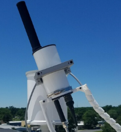

An image representing Pandora sensors.

Air Quality Forecasts and Distributed Pandora Sensors

The Pandora air quality sensors network is being expanded to include selected U.S. embassies in countries that have significant air quality issues and in agricultural/rural sites. The U.S. NASA's Global Modeling and Assimilation Office (GMAO) will integrate the Pandora data into the Goddard Earth Observing System-Composition Forecast (GEOS-CF) model with downscaling approaches used for more precise air quality forecasts at USDA and Department of State sites of interest. Sensor outputs and model data will be available online through the existing visualization platform.
Training Resources | Open Meetings and Workshops 

Catalog of Archived Suborbital Earth Science Investigations (CASEI)

CASEI facilitates quick access to detailed information about NASA’s Earth science airborne and field investigations and provides curated information about the context, research motivation, funding, and details of non-satellite instruments and platforms. Information about important events and observations are included, along with links to relevant data products, all in a single, intuitive, and highly interconnected web user interface.
Training Resources | Open Meetings and Workshops

Commercial Smallsat Data Acquisition (CSDA) Program

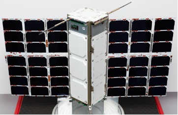
The Commercial Smallsat Data Acquisition (CSDA) program was established to identify, evaluate, and acquire data from commercial sources that support NASA's Earth science research and application goals. NASA began exploring the purchase of commercial land surface imagery and other products in 2018 and, based upon needs stated by agency partners, recently expanded license agreements to facilitate access to commercial imagery for researchers and many federal agencies. Read more about CSDA.
Training Resources | Open Meetings and Workshops

Global HLS-Derived Vegetation Indices Suite

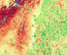
The Global HLS-Derived Vegetation Indices Suite (HLS-VIS) will be generated from the Harmonized Landsat Sentinel-2 (HLS) surface reflectance products and is expected to include the following indices: NDVI, EVI, SAVI, MSAVI, NDMI, NBR, NBR2, TVI, and NDWI. This Vegetation Indices Suite (VIS) will be generated from the HLS archive (December 2015 for Sentinel-2 and April 2013 for Landsat) and will continue forward with future HLS acquisitions as part of the HLS production system.
Training Resources | Open Meetings and Workshops

Harmonized Landsat Sentinel-2 (HLS)

HLS provides consistent surface reflectance (SR) data from the Operational Land Imager (OLI) aboard the joint NASA/USGS Landsat 8 and Landsat 9 satellites and the Multi-Spectral Instrument (MSI) aboard the ESA (European Space Agency) Copernicus Sentinel-2A and Sentinel-2B satellites. The combined measurement enables global observations of land every 2 to 3 days at 30 m spatial resolution. Our SEP effort provides resources on the use of HLS in collaboration with NASA’s Land Processes Distributed Active Archive Center (LP DAAC), Applied Sciences: Capacity Building program, and other partners.
Training Resources | Open Meetings and Workshops

Ice, Cloud & Land Elevation Satellite-2 (ICESat-2) Quick Look Products

Users of ICESat-2 data for various atmospheric, land, and ice analysis submitted needs for products to be generated with reduced latency. As a result, an SNWG solution focused on the generation of ICESat-2 “Quick Look” products, which can be delivered at reduced latency relative to the standard ICESat-2 products, is permanently archived by NASA's National Snow and Ice Data Center (NSIDC) DAAC. Quick Look versions of products have a latency of 3 to 5 days versus the typical 45-day latency of standard data products.
Training Resources | Open Meetings and Workshops

Merged Planetary Boundary Layer (PBL) Height Product

The Merged Planetary Boundary Layer (PBL) Height Product merges sounder and GNSS-RO data into a global product that will advance PBL process science and improve weather forecasting applications. It uses a consistent and modern hyperspectral sounding retrieval process to create higher-level science products of atmospheric variables complemented by new retrievals built from NASA, NOAA, and commercial GNSS-RO data (Spire).
Training Resources | Open Meetings and Workshops

Observation Products for End-Users for Remote Sensing Analysis (OPERA)

Started in April 2021, the Observation Products for End-Users for Remote Sensing Analysis (OPERA) Project at NASA's Jet Propulsion Laboratory collects data from satellite radar and optical instruments to generate three products that respond to needs identified by various federal agencies during the 2018 cycle (Cycle 2) of the Satellite Needs Working Group development activities, namely: a near-global Surface Water Extent product suite, a near-global Surface Disturbance product suite, and a North-America Displacement product suite.
Training Resources | Open Meetings and Workshops

TEMPO/GOES Near Real-Time Products

TEMPO was launched in April 2023 and will provide key air quality measurements of trace gas constituents over North America from a geostationary orbit. The TEMPO team will also produce near real-time (NRT) air quality products with a 3-hour latency for NO2, HCHO, and O2-O2 clouds along with a Level 1B product that will enable NOAA to produce an NRT aerosol product.
Training Resources | Open Meetings and Workshops

Last Updated