Global sea level has risen 8 to 9 inches since reliable record keeping began in 1880 and is projected to rise another 1 to 8 feet by 2100.
According to the United Nations, 40% of the world's population lives within 100 km of a coast, meaning that close to three billion people could be impacted by changes in sea level. Coastal communities are centers of economic, social, and cultural development; they also provide significant ecological and environmental services. Global Mean Sea Level (GMSL) is increasing at about 3.4 millimeters per year (mm/y) and is already having catastrophic effects in coastal communities through flooding, erosion, and storm-related hazards.
This Data Pathfinder is designed to help guide you through the process of selecting and using datasets applicable to sea level change, with guidance on resolutions and direct links to the data sources. If you are new to remote sensing, the What is Remote Sensing? Backgrounder provides a good overview. In addition, NASA's Applied Remote Sensing Training Program (ARSET) provides numerous training modules, including Fundamentals of Remote Sensing.
If you have specific questions about how to use data, tools, or resources mentioned in this Data Pathfinder, please visit the Earthdata Forum. Here, you can interact with other data users and NASA subject matter experts on a variety of Earth science research and applications topics.
An Overview of Sea Level Change
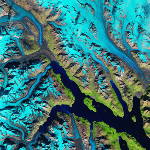
Long-term changes in global mean sea level (GMSL) are predominantly driven by three processes: Thermal expansion of ocean water as it absorbs heat, the addition of fresh water to the ocean from the melting of glaciers and ice sheets, and land water storage. As the atmosphere warms, much of its heat gets absorbed by the ocean, causing the water to expand. More than 90% of warming over the past 50 years has occurred in the ocean. Along with this thermal expansion, land-based glaciers and ice sheets are melting. Since 2002, Greenland is losing about 277 gigatonnes (Gt) of ice per year, based on measurements acquired by the Gravity Recovery and Climate Experiment (GRACE) and GRACE Follow-On (GRACE-FO) missions, and Antarctica losing approximately 149 Gt/year. To put this into perspective, one Gt is equivalent to one billion metric tons, 2.2 trillion pounds, or 10,000 fully-loaded U.S. aircraft carriers. New York's Central Park is 4 kilometers long and 0.8 kilometers wide. A gigatonne of ice placed in this equivalent area would extend 341 meters (1,119 feet) high. Finally, water that is either removed from land (through, for example, groundwater pumping) or impounded on land (through dam building) can cause a net change in the total water found in the ocean.
Locally and regionally, sea level change can be significantly different from the global average due to factors such as natural and human-induced subsidence (sinking or settling of the ground), ocean currents, and rebound from the compressive weight of Ice Age glaciers.
Exposure and vulnerability are important components in risk-management efforts and adaptation strategies. The presence of people, animals and ecosystems, environmental resources, infrastructure, or economic, social, and cultural assets in places and settings that could be adversely affected by a change in sea level is called exposure. Vulnerability is the propensity of a community to be adversely affected by sea level change, taking into consideration factors such as susceptibility to harm and lack of capacity to cope and adapt. Risk is determined by exposure and vulnerability to hazards.
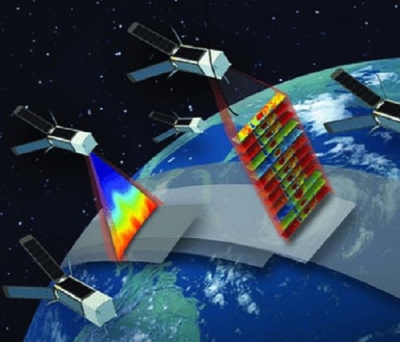
Our current scientific understanding of sea level change is unprecedented due to long-term sea level records and almost 30 years of satellite altimetry. Data available without restriction through NASA's Earth Observing System Data and Information System (EOSDIS) further support this understanding.
Common Measurements at a Glance
NASA collaborates with other federal entities and international space organizations to collect and distribute sea level data. NASA also provides datasets to help assess the impacts, exposure, and vulnerability of individual communities to rising sea levels.
Datasets referenced in this Pathfinder are from the satellite and airborne sensors shown in the table below, including their spatial and temporal resolutions. This table is not intended to be an exhaustive list of all sensors or missions producing data relevant to sea level change. Note that many satellites and platforms carry multiple sensors; the table below only lists the primary sensor used in collecting the specified measurement. When available, NASA's Land, Atmosphere Near real-time Capability for EO (LANCE) provides data to the public within three hours of a satellite observation, which allows for near real-time (NRT) monitoring and decision making (sensors from which select datasets are available in LANCE are marked with *).
Measurement
Satellite
Sensor
Spatial Resolution
Temporal Resolution
Changes in Ice Mass
Gravity Recovery and Climate Experiment (GRACE) and GRACE- Follow On (GRACE-FO)
Star Camera Assembly (SCA)
K-Band Ranging System (KBR)
SuperSTAR Accelerometer (ACC)
0.125°
7 day
Changes in Land Water Storage
GRACE, GRACE-FO
SCA, KBR, ACC
0.125°
7 day
Ice Elevation
Operation IceBridge, Ice, Cloud and land Elevation Satellite (ICESat),
ICESAT-2 and
LVIS
Advanced Topographic Laser Altimeter System (ATLAS)
Geoscience Laser Altimeter System (GLAS)
Glacier and Ice Surface Topography Interferometer (GLISTIN-A)
NASA Land Vegetation and Ice Sensor (LVIS)
ATLAS: ~70 cm - 20 m
GLAS: 60-70 m x 60-70 m
GLISTIN_A: 50 m
Field Campaigns (LVIS and IceBridge only)
ATLAS: 91 day
GLAS: 23 minute - 1,288 minute
Ice Sheet Mass Balance
ICESat and ICESat-2
ATLAS, GLAS
ATLAS: 20 m
GLAS: 60-70 m x 60-70 m
ATLAS: 91 day
GLAS: 23 minute - 1,288 minute
Ice Thickness
IceBridge, ICESat and ICESAT-2
ATLAS, GLAS, GLISTIN-A
ATLAS: 20 m
GLAS: 60-70 m x 60-70m
GLISTIN-A: 50 m
Field Campaign (only IceBridge)
ATLAS: 91 day
GLAS: 23 minute - 1,288 minute
Land Surface Backscatter
Advanced Land Observing Satellite-1 (ALOS)
Phased Array type L-band Synthetic Aperture Radar (PALSAR)
10 m, 100 m
Land Surface Backscatter
Sentinel-1
Synthetic Aperture Radar (SAR)
25 x 40 m, 5 x 5 m, and 5 x 20 m
12 days
Nighttime Imagery
Suomi National Polar-orbiting Partnership (Suomi NPP) and NOAA-20 satellites
Visible Infrared Imaging Radiometer Suite (VIIRS) *
500 m, 1,000 m, 5,600 m
Daily
Ocean Surface Wind Speed
Cyclone Global Navigation Satellite System (CYGNSS), ICESat-2
Delay Doppler Mapping Instrument (DDMI)
25 km x 25 km
3-7 hours
Sea Surface Salinity
Satelite de Aplicaciones Cientificas (SAC)
Aquarius
150 km
7 days
Sea Surface Salinity
Soil Moisture Active Passive (SMAP)
Radar (no longer functional), Microwave Radiometer
Air Surface Water and Ocean Topography (AirSWOT)
ATLAS
GLAS
AIRSWOT: 3.6 m
ATLAS: varies
GLAS: 60-70 m x 60-70 m
Field Campaign
ATLAS: 91 day
GLAS: 1,288 minute
Surface Reflectance
Suomi NPP and NOAA-20 satellites
VIIRS*
500 m, 1,000 m, 5,600 m
Daily
Surface Reflectance
Landsat 7
Enhanced Thematic Mapper Plus (ETM+)
15 m, 30 m, 60 m
16 days
Surface Reflectance
Landsat 8
Operational Land Imager (OLI)
Thermal Infrared Sensor (TIRS)
15 m, 30 m, 60 m
16 days
Surface Reflectance
Terra and Aqua
MODIS*
250 m, 500 m, 1,000 m, 5,600 m
1-2 days
Surface Slope
Delta-X Airborne
AirSWOT
3.6 m
Field Campaign
In addition to mission data, NASA has a series of models that use satellite- and ground-based observational data. There are a few reasons model data may be preferred over remote sensing observations, including the ability to obtain more complex data parameters, temporal coverage, spatial coverage, and data completeness.
Models are often used for projections and forecasts, but time is not the only dimension in which projections can be made. Models also can offer data in areas where sensors are unavailable. For instance, satellite observations of land surface temperatures can only be made where there is a clear view of land, and clouds and dust can obscure views. Observations are further dependent on the type of land cover; highly reflective areas, such as snow and urban areas, can be challenging to observe. A model allows researchers to fill these gaps by bringing in additional data from ground stations or other sensors that measure different wavelengths.
NASA's Modern-Era Retrospective analysis for Research and Applications, Version 2 (MERRA-2) model provides data beginning in 1980. Due to the amount of historical data available, MERRA-2 data can be used to look for trends and patterns as well as anomalies. As climate is typically measured over a 30-year period, MERRA-2 data are well suited for studies into the impacts of climate change.
The Ocean Surface Current Analysis Real-time (OSCAR) model is a pilot processing system and data center providing surface current estimates, which have been computed from satellite altimeter and vector wind data using methods developed during the TOPEX/Poseidon mission.
Model Source
Data Parameter
Spatial Resolution
Temporal Resolution
MERRA-2
Land surface temperature, surface humidity, winds, soil moisture
Sea level rise poses widespread and continuing threats to the economy and environment. We can assess impacts through various NASA datasets, including surface reflectance, socioeconomic data, and more.
Use the Data
Scientists, researchers, decision makers, and others use remote sensing data in numerous ways. Satellite data coupled with ground-based data aid in our understanding of the factors contributing to sea level change, forecasting, risk and response, impacts, and much more. NASA Earth science observations are transforming our approach to this critical issue.
Feature Articles and StoryMaps
Explore some of the stories behind the data in these feature articles highlighting research activities around the world:
NASA's Sea Level Change portal provides links to news, data, and other resources related to sea level change. Credit: NASA Sea Level Change.
Sea Level Change: This NASA-created portal provides a wealth of information on the factors contributing to sea level change globally and regionally. The site gives estimates for sea level rates for different time periods and data on the key indicators of change.
Interagency Sea Level Rise Scenario Tool: The sea level scenarios and information contained in this tool provide the most up-to-date sea level rise scenarios for all U.S. states and territories out to the year 2150. This tool is intended to inform coastal communities and others about current and future sea level rise to help contextualize its effects for decision making.
IPCC AR6 Sea Level Projection Tool: Available through NASA's Sea Level Change portal, the Sea Level Projection Tool allows users to visualize and download the sea level projection data from the Intergovernmental Panel on Climate Change (IPCC) 6th Assessment Report (AR6). The tool allows users to view both global and regional sea level projections from 2020 to 2150, along with how these projections differ depending on future scenario.
Earth Information System (EIS) Sea Level Change Pilot: The Sea Level Change pilot enables scientific collaboration related to understanding the processes contributing to sea-level change at the global and local scales to better understand past change and predict future change. Earth observations, models, and reanalysis data products of the atmosphere, oceans, cryosphere, and solid Earth are combined to show the processes and feedbacks governing sea-level change and their impacts at the coast.
Climate Time Machine: This application takes viewers on a journey to show how Earth's key climate indicators are changing over time. The sea level indicator contains visualizations to show the effect on coastal regions for each meter of sea level rise, up to 6 meters (19.7 feet).
External Resources
Image
NOAA's Sea Level Rise Viewer provides data and maps to illustrate the scale of potential flooding. Water levels are relative to Mean Higher High Water (MHHW) (excludes wind driven tides). Credit: NOAA.
Argo: Sponsored by NOAA, Argo is an international program designed to distribute 3,000 free drifting profiling floats over the global ocean to measure the temperature and salinity in the ocean's upper 2,000 m.
Sea Level Rise Viewer: This NOAA application is a web mapping tool for visualizing community-level impacts from coastal flooding or sea level rise (up to 10 feet above average high tides).
Coastal Inundation Dashboard: Developed by NOAA, this tool offers historic and real-time coastal flooding information at a majority of coastal water level stations.
Resilience Analysis and Planning Tool (RAPT): Created by the Federal Emergency Management Agency (FEMA), RAPt is a free GIS web map that enables users to examine the intersections of socioeconomic data, infrastructure, and natural hazards, including real-time meteorological forecasts, historic disasters and estimated annualized frequency of hazard risk.
Sea Level Research Group: Based at the Colorado Center for Astrodynamics Research at the University of Colorado at Boulder, this group continuously monitors satellite altimetry data against a network of tide gauges, subtracting seasonal variations to estimate global mean sea level rate.
Connection of Sustainable Development Goals to Sea Level Change
The Sustainable Development Goals (SDGs) are a collection of 17 interlinked global goals designed to be a blueprint for a sustainable future for all of Earth’s inhabitants. The SDGs are part of the 2030 Agenda for Sustainable Development, an international plan signed by all United Nations (UN) member states in 2015 and underpinned by the foundational components of People, Planet, and Prosperity.
The 17 SDGs in the Agenda are made up of 169 objectives that include specific social, economic, and environmental targets. These targets provide a blueprint for developing a more sustainable global future.
Data acquired remotely by sensors aboard satellites and aircraft or installed on the ground play a unique role in tracking the progress toward achieving the SDGs. These remotely sensed Earth observations provide consistent and continuous information on the state of Earth processes and their change over time. These data also are integral components of socioeconomic metrics that provide a measure of how humans co-exist with the environment and the stresses they encounter through natural and human-caused changes to the environment. NASA Earth observation data are available without restriction to all data users, a policy that is being adopted by other international space agencies and one that reduces the cost of monitoring the SDGs and provides developing countries a means to acquire and utilize these data for other policy-making purposes.
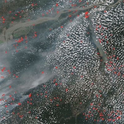
NASA’s datasets are organized by topics that help users to locate, access, and apply relevant and complementary datasets for each SDG. The Wildfire Data Pathfinder addresses (but is not limited to) the following SDGs:
SDG
SDG Goals Relevant to Sea Level Change
Image
Goal 1. End poverty in all its forms everywhere
Target 1.5: By 2030, build the resilience of the poor and those in vulnerable situations and reduce their exposure and vulnerability to climate-related extreme events and other economic, social, and environmental shocks and disasters.
Image
Goal 2. End hunger, achieve food security and improved nutrition, and promote sustainable agriculture
Target 2.4: By 2030, ensure sustainable food production systems and implement resilient agricultural practices that increase productivity and production; that help maintain ecosystems; that strengthen capacity for adaptation to climate change, extreme weather, drought, flooding, and other disasters; and that progressively improve land and soil quality.
Image
Goal 11. Make cities and human settlements inclusive, safe, resilient and sustainable
Target 11.5: By 2030, significantly reduce the number of deaths and the number of people affected and substantially decrease the direct economic losses relative to global gross domestic product caused by disasters, including water-related disasters, with a focus on protecting the poor and people in vulnerable situations.
Image
Goal 13. Take urgent action to combat climate change and its impacts
Target 13.1: Strengthen resilience and adaptive capacity to climate-related hazards and natural disasters in all countries.
Target 13.2: Integrate climate change measures into national policies, strategies, and planning.
Target 13.3: Improve education, awareness-raising, and human and institutional capacity on climate change mitigation, adaptation, impact reduction, and early warning.
The opportunities to connect NASA data to the SDGs are infinite; therefore, the datasets included in specific Data Pathfinders are not intended to be comprehensive. Additionally, NASA datasets are not official indicators for SDG monitoring and decision-making but are complementary.
This section provides links to tools and applications relevant to analyzing and visualizing sea level change data referenced in this Data Pathfinder. NASA's Earth Science Data Systems (ESDS) Program maintains many more resources for data analysis that may be helpful. Explore the full list on the NASA Earthdata Data Tools page.
Earthdata Search
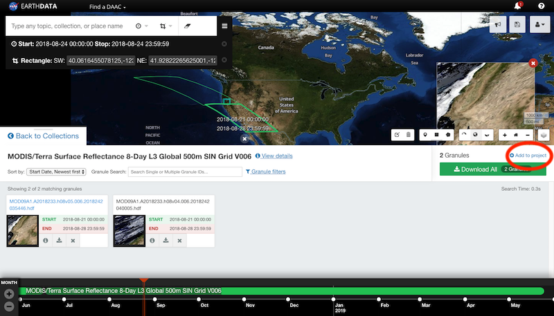
Earthdata Search is a tool for discovering Earth observation data collections from EOSDIS as well as U.S and international agencies across Earth science disciplines. Users (including those without specific knowledge of the data) can search for and read about data collections, search for data files by date and spatial area, preview browse images, and download or submit requests for data files, with customization for select data collections. Note: While anyone can search for data and browse datasets, an Earthdata Login registration is required to download data.
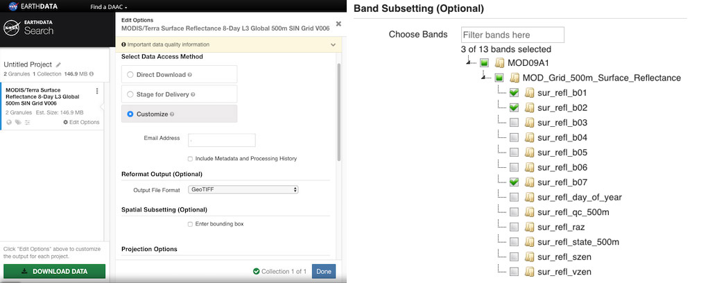
In the project area, for some datasets, you can customize your granule. You can reformat the data and output as HDF, NetCDF, ASCII, KML, or a GeoTIFF. You can also choose from a variety of projection options. Lastly, you can subset the data to obtain only the bands needed.
HDF and NetCDF files can be viewed using NASA's Panoply data viewer, which is a cross-platform application that plots geo-referenced and other arrays. Panoply offers additional functionality, such as slicing and plotting arrays, combining arrays, and exporting plots and animations.
Panoply videos on the NASA Earthdata YouTube channel:
Giovanni is an online environment for displaying and analyzing geophysical parameters that provides many options for analysis. Note: An Earthdata Login is required to access Giovanni. The following are the more popular ones:
Time-averaged maps: A simple way to observe the variability of data values over a region of interest
Map animations: A means to observe spatial patterns and detect unusual events over time
Area-averaged time series: Used to display the value of a data variable that has been averaged from all the data values acquired for a selected region for each time step
Histogram plots: Used to display the distribution of values of a data variable in a selected region and time interval
Data recipe for downloading a Giovanni map in NetCDF format and converting its data to quantifiable map data in the form of latitude-longitude-data value ASCII text
The NASA Worldview visualization application provides the capability to interactively browse over 1,000 global, full-resolution satellite imagery layers and then download the underlying data (Note: An Earthdata Login is required to download data). Many of the available imagery layers are updated within three hours of a satellite observation, which supports time-critical applications such as wildfire management, air quality measurements, and flood monitoring. Imagery in Worldview is provided by NASA's Global Imagery Browse Services (GIBS). Worldview also includes nine geostationary imagery layers from the NASA/NOAA Geostationary Operational Environmental Satellite-East (GOES-East) and GOES-West satellites and from the Japan Meteorological Agency Himawari-8 satellite. These layers are available at 10-minute increments for the last 30 days, and include Red Visible, which can be used for analyzing daytime clouds, fog, insolation, and winds; Clean Infrared, which provides cloud top temperature and information about precipitation; and Air Mass RGB, which enables the visualization of the differentiation between air mass types (e.g., dry air, moist air, etc.). These full disk hemispheric views allow for almost real-time viewing of changes occurring around most of the world.
Image
Worldview Suomi NPP/VIIRS nighttime lights comparison image showing power outages caused by Hurricane Irma in September 2017. The right image (acquired September 1) shows the island before Hurricane Irma. The left image (acquired September 9) shows power outages across island after the storm. Credit: NASA Worldview.Back to top of Tools section
HiTIDE
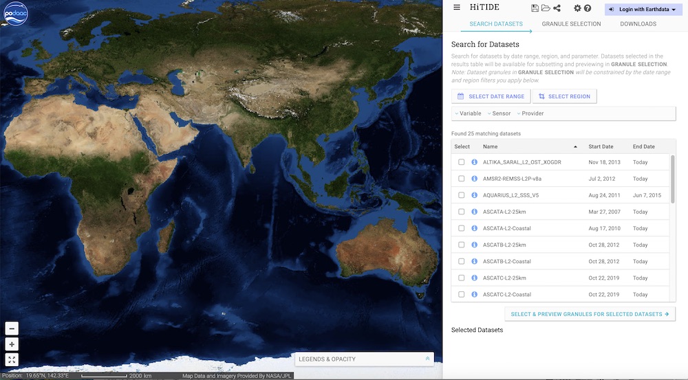
HiTIDE allows users to subset and download popular Level 2 datasets distributed by NASA's Physical Oceanography Distributed Active Archive Center (PO.DAAC). Users can search across a wide variety of parameters (such as variables, sensors, and platforms) and filter the resulting data based on spatial and temporal boundaries of interest. HiTIDE also offers instant previews of variable imagery, allowing users to rapidly find data of interest to download at a later time. A tutorial is provided for new users by clicking on the question mark in the upper right corner. Note: An Earthdata Login is required to download data from HiTIDE.
PO.DAAC's State of the Ocean (SOTO) is an interactive web-based tool that generates informative maps, animations, and plots for a broad range of satellite-derived products and key parameters of interest to the oceanographic community.
AppEEARS, from NASA's Land Processes DAAC (LP DAAC), offers a simple and efficient way to access and transform geospatial data from a variety of federal data archives. AppEEARS enables users to subset geospatial datasets using spatial, temporal, and band/layer parameters. Two types of sample requests are available: point samples for geographic coordinates and area samples for spatial areas via vector polygons. Note: An Earthdata Login is required to use AppEEARS.
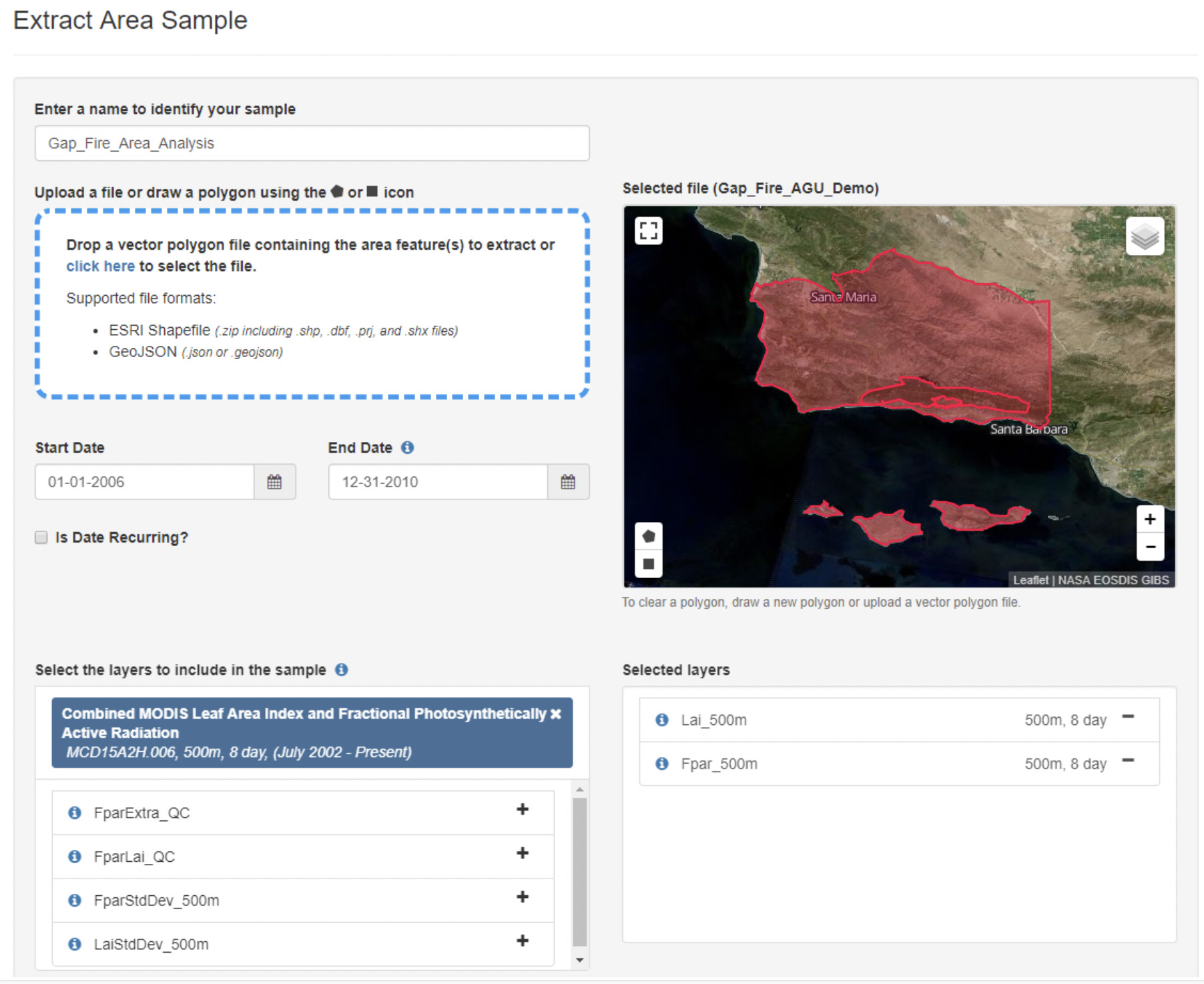
Performing Area Extractions
After choosing to request an area extraction, you will be taken to the Extract Area Sample page where you will specify a series of parameters that are used to extract data for your area(s) of interest.
Spatial Subsetting
Define your region of interest in one of these three ways:
Upload a vector polygon file in shapefile format (you can upload a single file with multiple features or multipart single features); the .shp, .shx, .dbf, or .prj files must be zipped into a file folder to upload
Upload a vector polygon file in GeoJSON format (can upload a single file with multiple features or multipart single features)
Draw a polygon on the map by clicking on the Bounding box or Polygon icons (single feature only)
Select the date range for your time period of interest.
Specify the range of dates for which you wish to extract data by entering a start and end date (MM-DD-YYYY) or by clicking on the Calendar icon and selecting dates a start and end date in the calendar.
Adding Data Layers
Enter the product short name (e.g., MOD09A1, ECO3ETPTJPL), keywords from the product long name, a spatial resolution, a temporal extent, or a temporal resolution into the search bar. A list of available products matching your query will be generated. Select the layer(s) of interest to add to the Selected layers list. Layers from multiple products can be added to a single request. Be sure to read the list of products available through AppEEARS.
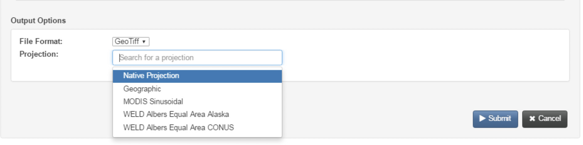
Selecting Output Options
Two output file formats are available:
GeoTIFF
NetCDF-4
If GeoTIFF is selected, one GeoTIFF will be created for each feature in the input vector polygon file for each layer by observation. If NetCDF-4 is selected, outputs will be grouped into .nc files by product and by feature.
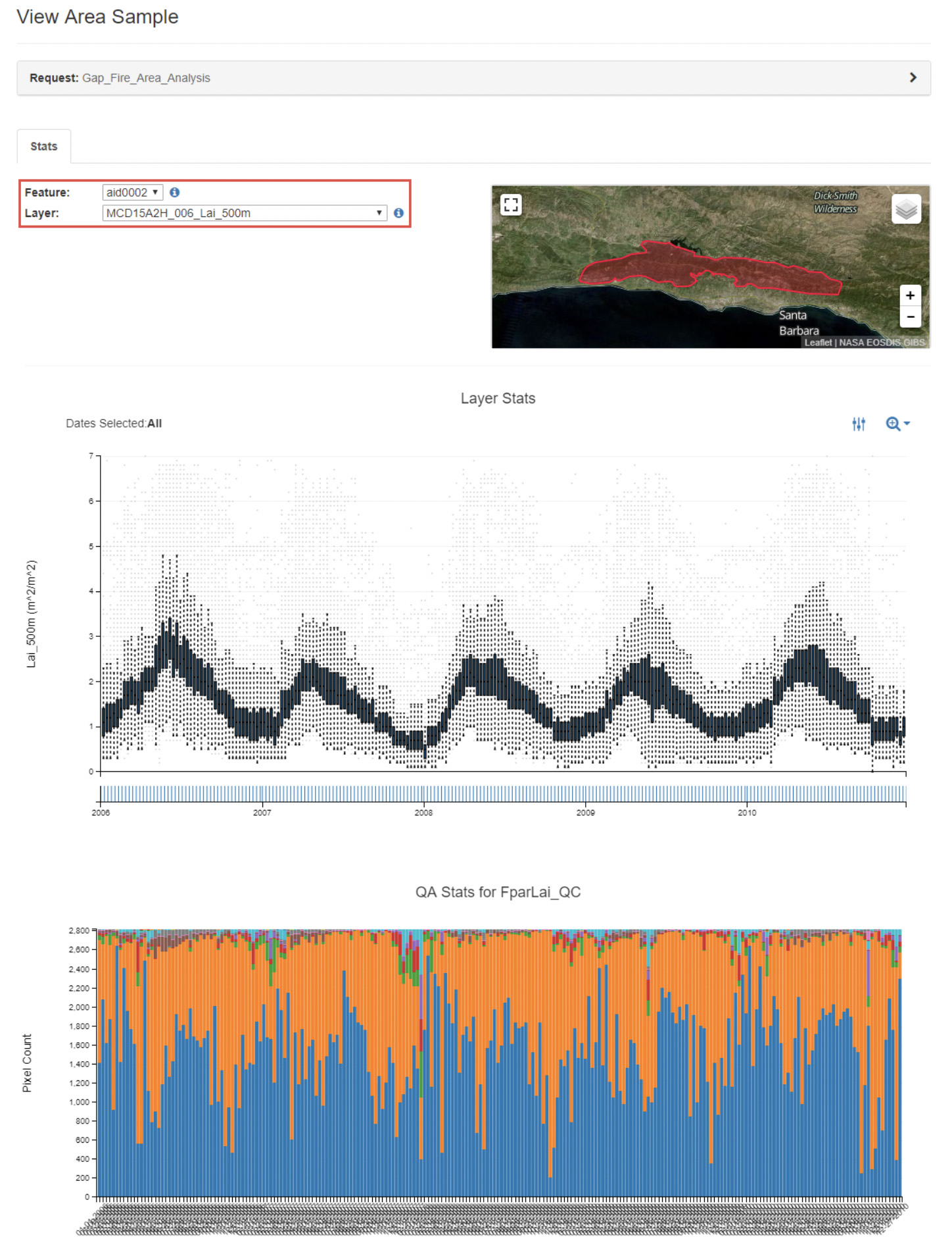
Interacting with Results
Once your request is completed, from the Explore Requests page, click the View icon in order to view and interact with your results. This will take you to the View Area Sample page.
The Layer Stats plot provides time series boxplots for all of the sample data for a given feature, data layer, and observation. Each input feature is renamed with a unique AppEEARS ID (AID). If your feature contains attribute table information, you can view the feature attribute table data by clicking on the Information icon to the right of the Feature dropdown. To view statistics from different features or layers, select a different AID from the Feature dropdown and/or a different layer of interest from the Layer dropdown.
Check out the AppEEARS documentation to learn more about downloading the output GeoTIFF or NetCDF-4 files.
NASA's Oak Ridge National Laboratory DAAC (ORNL DAAC) has several MODIS and VIIRS Subset Tools for subsetting data:
Global Subset Tool: Users can request a subset for any location on Earth provided as GeoTiff and in text format, including interactive time-series plots and more. Users specify a site by entering the site's geographic coordinates and the area surrounding that site, from one pixel up to 201 x 201 km. From the available datasets, users can specify a date and then select from MODIS Sinusoidal Projection or Geographic Lat/Long. Note: An Earthdata Login is required to download data.
Fixed Subsets Tool: Users can download pre-processed subsets for more than 3,000 field and flux tower sites for validation of models and remote sensing products. The goal of the Fixed Sites Subsets Tool is to prepare summaries of selected data products for the community to characterize field sites. It includes sites from networks such as NEON, ForestGeo, PhenoCam, and LTER that are of relevance to the biodiversity community.
Web Service: Users can retrieve subset data (in real-time) for any location(s), time period, and area programmatically using a REST web service. Web service client and libraries are available in multiple programming languages, allowing integration of subsets into users' workflow.
The ESA (European Space Agency) Sentinel-1 mission consists of two satellites, Sentinel-1A and Sentinel-1B, with synthetic aperture radar (SAR) instruments operating at a C-Band frequency. The satellites orbit 180° apart and image Earth every six days. SAR is an active sensor that can penetrate cloud cover and vegetation as well as create observations at night. It also provides useful information to create an interferogram to analyze displacement after an earthquake, volcanic eruption, or landslide. While SAR data are complex to process, ESA has developed a Sentinel-1 Toolbox to aid with processing and analysis of Sentinel-1 data.
SAR Interferometry
Once you have downloaded the data (a data file before the event and a data file after the event), you need to coregister the two files and then create an interferogram. The process for doing this is:
Visualize: Open the files in the Sentinel Toolbox. Important note: DO NOT unzip the downloaded SAR file. When you expand the Bands folder, you will find bands containing the real (i) and imaginary (q) parts of the complex data. In Sentinel-1 IW SLC products, you will find three sub-swaths labeled IW1, IW2, and IW3. To view the data, double-click on the Intensity_Sub-Swath_Polarization band of one of the two images.
Coregister: For interferometric processing, two or more images must be coregistered into a stack. One image is selected as the master and the other images are the "slaves." The pixels in "slave" images will be moved to align with the master image to sub-pixel accuracy. To do this, select Radar/Coregistration/S-1 TOPS Coregistration. For more information on this type of processing, view Sentinel Online's Terrain Observation with Progressive Scans SAR (TOPSAR) processing technique.
In the Read tab, select the first product. This should be the earlier of the two SLCs.
In the Read(2) tab, select the other product. This will be your "slave" image.
In the TOPSAR-Split tabs, select the appropriate sub-swath and polarization for each of the products.
In the Apply-Orbit-File tabs, select the Sentinel Precise Orbit State Vectors. If precise orbits are not yet available for your product, you may select the restituted orbits, which may not be as accurate but will be better than the predicted orbits available within the product.
Image
Sentinel-1 Toolbox coregistration process. Note the arrow to the left and right in the coregistration window; it will cycle through the different tabs. Credit: ESA.
In the Back-Geocoding tab, select the Digital Elevation Model (DEM) to use and the interpolation methods. The default is the Shuttle Range Topography Mission 3 Sec DEM.
In the Write tab, set the Directory path to your working directory.
Click Run to begin coregistering the data. The resulting coregistered stack product will appear in the Product Explorer window with the suffix Orb Stack.
Interferogram: The interferogram is formed by cross-multiplying the master image with the complex conjugate of the "slave." The amplitude of both images is multiplied while their respective phases are differenced to form the interferogram.
Select the new stack file in the product explorer and then select Radar/Interferometric/Products/Interferogram Formation.
Keep the default values for Interferogram Formation, but confirm that the output Directory path is correct.
Click Run.
Image
Through the interferometric processing flow, the tool tries to eliminate other sources of error so that what is left is typically the surface deformation related to an event. You can visualize the phase information at this step.
Interferometric fringes represent amount of displacement. Fringes appear on an interferogram as cycles of colors, with each cycle representing relative range difference of half a sensor's wavelength. Relative ground movement between two points can be calculated by counting the fringes and multiplying by half of the wavelength. The closer the fringes are together, the greater the strain on the ground.
Multilooking and Phase Filtering: The phase associated with topography has to be removed and additional phase filtering to reduce noise and enhance the appearance of the deformation fringes.
Step-by-step directions for this can be found within InSAR data recipes at NASA's Alaska Satellite Facility DAAC (ASF DAAC).
The NASA Flooding Analysis Tool was developed to allow practitioners and decision-makers to assess how sea level rise and other factors will affect the frequency of high-tide flooding in coming decades on a location-specific basis. The tool enables results to be viewed for multiple future sea level rise scenarios across a range of flooding thresholds. Flooding projections are based on an analysis of astronomical tides and other natural fluctuations in tide gauge data in combination with sea level rise projections based on climate models.
The tool lets users:
Customize projections: Select a location, sea level rise scenario, and flooding threshold of interest and see likely ranges for the projections to assess various risk levels
See changes from decade to decade: View the number of flooding events during a typical year and the most severe year in each decade during the 21st century
Identify relevant planning horizons: Find out when to expect the frequency of flooding to reach a given number of events per year and when and how long it will take for occasional flooding to transition into a chronic issue
The tool was developed by scientists at the University of Hawaii Sea Level Center and funded by the NASA Sea Level Change Team along with support from the NASA Climate Adaptation Science Investigators (CASI2) project.
 billion people could be impacted by changes in sea level. Coastal communities are centers of economic, social, and cultural development; they also provide significant ecological and environmental services. Global Mean Sea Level (GMSL) is increasing at about 3.4 millimeters per year (mm/y) and is already having catastrophic effects in coastal communities through flooding, erosion, and storm-related hazards.

 (excludes wind driven tides). Credit: NOAA")


 is an interactive web-based tool to generate informative maps, animations, and plots that communicate and prove the discovery and analysis of the state of the oceans.")