On September 11, 2001, the collapse of the World Trade Center in New York City sent a pillar of noxious gases and particles high into the atmosphere. People around the world recognize photographs of the towers burning and collapsing as iconic images of that day. Now, some lesser-known images are grabbing the attention of the scientific community because of the questions they help to answer.
Among other questions, the aftermath of the collapse left citizens, policy makers, and scientists alike wondering, “How can we measure the effects of the World Trade Center disaster on people’s health and on the environment?” Photographs showed plumes of smoke and debris billowing into New York City streets and into the air. Scientists wanted to assess how and where the miniscule debris particles and invisible toxic gases were dispersed into the atmosphere. One crucial piece of data was missing: they needed to know how high the smoke rose up into the atmosphere above the World Trade Center site so that they could determine where it traveled.

Ralph Kahn, a senior research scientist at the Jet Propulsion Laboratory, is Aerosol Scientist for the Multi-Angle Imaging Spectroradiometer (MISR) instrument, which flies on NASA’s Terra satellite. He said, “With other available data, there was no information that specifically said how high the plume had reached.” On the day of the disaster, power outages spread across New York City; no instruments deployed on the ground could measure plume elevation, and many that collect aerosol samples became so clogged with particles that they no longer functioned. Orbiting satellites, however, remained unharmed, and MISR data proved useful in measuring the height of the smoke plume.
Calculating the height of the plume
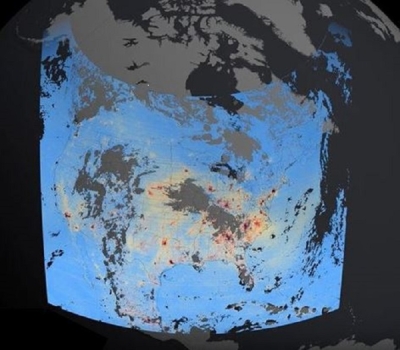
To study the potential impacts of the pollutants that dispersed when the World Trade Center collapsed, researchers needed to know when, where, and how many particles entered the atmosphere. The MISR instrument captured images on September 12, 2001, which the researchers retrieved from NASA's Atmospheric Science Data Center (ASDC). These data allowed the scientists to measure the plume of pollutant particles billowing from the buildings.
The researchers used a calculation technique called parallax. Parallax is similar to the way a locust measures distance. By bobbing from side to side, shifting weight on its legs and pivoting its abdomen, a locust is able to decide just how high and far to jump in order to reach its next landing strip. It uses these slight movements to “see” the difference in location of its target from varying points of view—the object’s apparent shift against a fixed background. In a similar manner, the MISR instrument captured images of the World Trade Center smoke cloud from multiple angles, all within a few minutes of each other, as the satellite scanned the globe. The scientists could pinpoint the height of the plume by looking down at the scene from slightly different positions in the sky above.
The MISR data enabled Kahn and his colleagues on the MISR team to calculate the maximum height and drift of the smoke plume billowing from the World Trade Center site. With the MISR data, Kahn calculated the height of the plume, composed of sub-visible aerosols, to be 1.25 to 1.5 kilometers (0.78 to 0.93 miles), at four sites, as the smoke drifted 70 kilometers (44 miles) downwind on September 12. Kahn said, “Most people were surprised the plume got as high as it actually did.”

Pinpointing the drift
The plume-height information proved crucial to other researchers studying the plume, like scientific modeler Georgiy Stenchikov at the Department of Environmental Science at Rutgers University. Stenchikov wanted to use his fine-scale meteorological and aerosol transport models to calculate where and in what quantity the World Trade Center pollutants drifted over the areas around New York City.
Stenchikov compared his model output to the limited ground-based data available: winds observed at automated meteorological stations in Central Park and at nearby airports, and observations from the rooftops of public school buildings in Queens, Brooklyn, and Manhattan. But the plume in his model did not seem to be in the right place. He thought he needed more information. Kahn said, “Georgiy was modeling the plume and wanted to know what we had to offer with the MISR data that could help refine his model.”
The missing input for Stenchikov’s model was the data on plume height. He needed to pinpoint how high the particles from the conflagration rose, so that he could identify the atmospheric layer they ended up in, and thus determine how far the pollutants traveled. Kahn said, “Wind speed and direction depend on elevation in the atmosphere. So in general, if the aerosol ends up higher in the atmosphere, it is likely to travel a lot farther.” Particles lifted by winds blowing over land initially stay in the layer of the atmosphere closest to the surface of the Earth. However, if particles are lifted by a hot, buoyant source, like a wildfire, volcano, or burning building, the plume can bubble up above the nearsurface layer of the atmosphere and reach a higher elevation.
Once Stenchikov obtained the correct plume height from MISR, he used it to refine his model and calculate the concentration of aerosols released into the atmosphere. Stenchikov said, “When we put the plume height from MISR into our simulations, we reproduced the position of the plume on September 12 very well.”

Interdisciplinary studies
Stenchikov passed along the aerosol concentration data from his model simulations to investigators from the Environmental and Occupational Health Sciences Institute, who were assessing the human exposure to the pollutants. The ongoing work to understand how pollution is dispersed in the atmosphere and to assess its subsequent impact on the environment involves researchers from many different fields. Kahn said, “We are now in a position to monitor aerosol behavior using satellite data combined with surface data, aircraft data, and models in a way that we have never been able to do before.”
Scientists can now use these same techniques to study other events, like the burning of fossil fuels or the pollution generated from power plants. Stenchikov said, “The combination of satellite observations and modeling is a very fruitful approach, because we cannot believe in the models completely until we validate with observations, and observations do not provide complete information.” Researchers can extend these findings to estimate the quantity and drift of pollutants released into the air, and assess the impact of air-quality events on human and environmental health. Ground station data recorded by the Environmental Protection Agency, for instance, can be combined with satellite data to provide information about exposure patterns that can affect people and the environment.
Both Kahn and Stenchikov value the interdisciplinary nature of studies like this. Kahn said, “We have different backgrounds and we come with different expertise, and we’re putting our expertise together to get an answer. When we are all done, we have some ‘golden days,’ as we like to call them—days when all of the data falls into place. Those are the nuggets.”
References
Kahn, R. A., W. -H. Li, C. Moroney, D. J. Diner, J. V. Martonchik, and E. Fishbein. In press. Aerosol source plume physical characteristics from spacebased multi-angle imaging. Journal of Geophysical Research .
Stenchikov, G., N. Lahoti, P. J. Lioy, P. G. Georgopoulos, D. J. Diner, and R. Kahn. 2006. Multiscale plume transport from collapse of the World Trade Center on September 11, 2001. Environmental Fluid Mechanics 6(5): 425–450
For more information
NASA Atmospheric Science Data Center (ASDC)
Multi-Angle Imaging Spectroradiometer (MISR)
Department of Environmental Science at Rutgers University
| About the remote sensing data | ||
|---|---|---|
| Satellite | Terra | |
| Sensor | Multi-Angled Imaging Spectroradiometer (MISR) | |
| Data set | MISR Level 2 Top of Atmosphere/Cloud Stereo and Aerosol data products from September 12, 2001 |
|
| Resolution | 1.1 kilometers horizontal (stereo height); 17.6 kilometers (aerosol optical depth) | |
| Parameters | Stereo height; aerosol optical depth | |
| DAAC | NASA Atmospheric Science Data Center (ASDC) | |