In the National Archives in Boston, stacks of fishing logbooks from the 1880s detail the once abundant catches of cod off the coast of New England. The skippers who kept these logbooks 150 years ago would have been sad if they had known the rest of the story. So in demand that Europeans called it “British gold,” the cod’s mild-flavored flesh sparked a Cod War between Iceland and the United Kingdom in the 1950s. Then trawlers increased catches dramatically, and the fish population crashed by the 1990s. Cod catches in New England are now a measly five percent of what fishermen used to catch in the 1880s.
Today in San Diego, California, logbooks tell a similar story: forty years of skippers’ notes and statistics from the Inter-American Tropical Tuna Commission (IATTC) detail increasing catches and growing fishing efforts in the eastern Pacific Ocean. The IATTC, whose member countries manage fish stocks in the region, imposes an annual quota on how much fish each country is allowed to catch—in hopes of averting a fate similar to the cod.
With three of four major species of tuna in the eastern Pacific Ocean fully exploited, scientists think that better fish forecasts and quotas could save the tuna. Biological oceanographer Dale Kiefer said, “Fishermen use a lot of satellite imagery. We want to catch up with them.” Kiefer and his colleagues have some novel ideas about fusing logbook data with satellite data to keep boats away from younger fish and allow the tuna population to recover.
Ode to the tuna

Like cod, the tuna is much sought after, whether for humble casseroles or elegant sushi. The fish is also a swimming machine. The bluefin tuna, for example, is so streamlined that its silver gunmetal body can swim across the Pacific Ocean in twenty-six days. Its speed comes from its unique red muscles—that tasty sashimi flesh—which stay 20 degrees Fahrenheit warmer than the surrounding water, allowing the fish to feed on fast prey in a huge range of environments. Tagged Pacific bluefin tuna, which spawn off the coast of Japan, have been caught off the coasts of Mexico and southern California.
Their prodigious range used to make the fish hard to find. Before the 1950s, fishermen watched for frolicking porpoises, or small marine life like squid, tuna crabs, and birds. Skippers tracked the sea surface temperatures that different species of tuna favored. They also hunted tuna on the fringes of murky, chlorophyll-rich areas of the ocean, finding them feasting on plankton-feeding fish.
But technological improvements in the 1950s, like the invention of nylon, made the tuna easier to catch. Instead of multiple fishing poles, stronger and larger nylon nets stretched for miles, snagging huge catches. By the 1960s, scientists saw a decline in yellowfin tuna in the eastern Pacific Ocean. The nets also snagged sharks, porpoises and turtles, prompting protests by conservation groups. The IATTC brought together all countries fishing in the region to address these problems through stock assessments and quotas.
The pursuit of fish

In spite of these measures, tuna continued to decline. In the 1980s, tuna boats began using radars and satellite data on sea surface temperature, sea surface height, thermocline depth, and chlorophyll concentrations to find fish. Smaller boats that hugged the coastline evolved into fleets of ships with larger holding tanks that could fish longer and farther from shore.
Responding to public pressure, the IATTC member countries called for a new approach. It was the push Kiefer and his colleague Michael Hinton, fisheries oceanographer and scientist with the IATTC, needed for their project. The IATTC’s scientific team provides stock assessments to fisheries managers to help them decide when to close areas to fishing, and what fishing quotas to assign to each country. Conservation organizations pointed out that as of 2011, yellowfin, bigeye, and Pacific bluefin tunas are overfished, which could mean the quotas are too high. Kiefer and Hinton think regulators need more precise tools to help with their decision making.
“The problem with stock assessments is that they are mostly based on numbers from fishing logbooks,” Kiefer said. He wanted to put the ecosystem in the equation. “There is surprisingly little use of satellite imagery in managing fisheries,” he said. “The eastern Pacific Ocean is enormous and dynamic. Large climate patterns like the El Niño affect how tuna move around.” Kiefer and Hinton thought that the satellite data could give decision makers a better picture of the fish’s habitat.
Dynamic maps
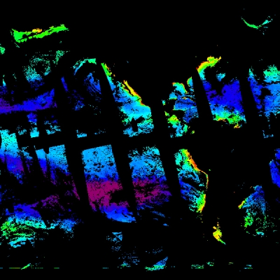
Kiefer and his team developed the Pelagic Habitat Analysis Module (PHAM), which combines logbook data with satellite data, including sea surface temperature data from the Moderate Resolution Imaging Spectroradiometer (MODIS) sensor, and ocean chlorophyll data from the Sea-Viewing Wide Field-of-View (SeaWiFS) sensor. PHAM also uses tuna tagging data, ocean circulation models, and global information system data. To limit catches, regulators restrict the number of tuna boats and fishing days, and where boats can go. But the distribution of tuna is not static. Tuna move with the season, ocean currents, water temperature, and with the concentration of chlorophyll on the sea surface.
“PHAM generates dynamic maps of the tuna habitat, giving regulators more information, in addition to the stock assessments, when deciding on quotas and when temporarily closing areas to fishing to allow stocks to recover,” Kiefer said. Hinton, who developed the stock assessment model for PHAM, said “Some people find working with satellite and environmental data a big morass of intractability. PHAM gives them the ability to take these satellite products and use them in their statistical analysis.”
Scientists who put together the IATTC’s yearly stock assessments are currently testing PHAM. Tester Alexandre Aires-da-Silva said, “We often have to produce these stock assessments under a lot of pressure. This tool allows us to rapidly manipulate these satellite data sets that we wouldn’t have had time to put together.” Mark Maunder, who heads the IATTC stock assessment team, said PHAM’s biggest value is in identifying areas where tuna boats might accidentally harvest by-catch species like dolphins.
A fisherman’s mind

Kiefer was still unsure about the dependability of the fishing logbook data. He said, “The most frustrating challenge is to take these data, which are governed by strategies and decisions made by fishermen, and to turn them into sound information about the fish’s location, distribution, and habitat.” Scientific studies are traditionally based on random sampling or a fixed array. “Getting information from a biased party is not the way scientists do things,” Kiefer said.
Kiefer’s colleague, environmental studies professor D. G. Webster, saw this weakness as an opportunity to learn more about the fish and its pursuers. Kiefer said, “She wanted to put the mind of the fisherman right in the software.” Webster is taking PHAM and integrating it onto another software called Fishscape, an ambitious effort to create a four-dimensional mathematical model of the entire fishery in the eastern Pacific Ocean—from the fish in the water, to the regulations made by fisheries managers, to the skippers and their fleets. Webster said, “We will use PHAM to combine data on the ocean with Fishscape’s data on the fishers, the markets, and even the political policies to fully understand the dynamics of a fish stock’s resilience or its collapse.”
Virtual fishermen
Fishscape is a little like SimCity, a simulation game where the city’s residents react to changes in the environment introduced by the game’s player. Like SimCity, Fishscape will be populated by residents—in this case, virtual fishermen. Webster interviewed dozens of fishermen to model how they behave in different situations. She is using this information to create virtual fishers who will fish in the simulation using real environmental and fish fleet data from PHAM. “We want to find out if there are behaviors of the fishermen that allow them to keep catching fish, even though there aren’t many fish out there,” Webster said.
Although it uses computer modeling that borrows elements from game theory, Webster does not want Fishcape to be taken lightly. “We’re not going to have cute little avatars going out on virtual fishing boats, selling fish in virtual markets with prices that have no relationship with supply or demand,” she said. When Fishscape is completed in 2013, Webster will test and study three scenarios. “We want to know how climate change, an increase in the price of oil, and further technological improvements in the fishing fleets could impact the sustainability of fisheries—that is, the ability of the fish, the fishers, and fish consumers to thrive now and in the future,” she said.
Webster is optimistic that Fishscape can shed light on the relationship between ocean currents, food availability, and fishes’ reproductive success. More importantly, it could help prevent the eastern Pacific tuna and other fish stocks from crashing like the North Atlantic cod. “It will break down barriers to cooperation by moving the focus away from conflict over who gets what—and the related inability to prevent the decline of stocks—to agreement on management that can improve conditions for everyone, even the fish,” she said.
References
Armstrong E., D. Kiefer, F. O’Brien, D. P. Harrison, M. Hinton, S. Kohin, and S. Snyder. 2009. The Pelagic Habitat Analysis Module (PHAM): Decision support tools for pelagic fisheries. Eos Transactions of the American Geophysical Union 90(52).
Webster, D.G. 2011. The irony and the exclusivity of Atlantic bluefin tuna management. Marine Policy 35: 249–251, doi:10.1016/j.marpol.2010.08.004.
For more information
NASA Ocean Biology Distributed Active Archive Center (OB.DAAC)
NASA Physical Oceanography DAAC (PO.DAAC)
Moderate Resolution Imaging Spectroradiometer (MODIS)
Sea-Viewing Wide Field-of-View Sensor (SeaWiFS)
Pelagic Habitat Analysis Module
Inter-American Tropical Tuna Commission (IATTC)
| About the remote sensing data used | ||
| Satellites | Terra and Aqua | SeaStar |
| Sensors | Moderate Resolution Imaging Spectroradiometer (MODIS) | Sea-Viewing Wide Field-of-view Sensor (SeaWiFS) |
| Data sets | GHRSST Sea Surface Temperature | SeaWiFS Daily Chlorophyll Data |
| Resolution | 0.25 degree | 4 kilometer, 9 kilometer |
| Parameters | Sea surface temperature | Ocean color |
| DAACs | NASA Physical Oceanography Distributed Active Archive Center (PO.DAAC) | NASA Ocean Biology DAAC (OB.DAAC) |
A tuna boat uses a purse seine net to surround a school of tuna in the eastern Pacific Ocean. The net is drawn closed at the bottom, like a purse, to prevent the fish from escaping. (Photograph by C. Orange courtesy NOAA Photo Library)