Dr. Anna Wilson, Field Research Manager at the Center for Western Weather and Water Extremes, Scripps Institution of Oceanography, University of California San Diego

Research Interests: Developing accurate representations of atmospheric rivers and other extreme events in forecasts and projections to support science-based resource management strategies; identifying data gaps to support operational numerical weather prediction needs, both for situational awareness and for assimilation into model runs; and improving the understanding of the physical processes extreme weather events to accurately predict hazards that impact life and property
Research Highlights: Atmospheric rivers — flowing columns of water vapor that move through the atmosphere — are responsible for producing significant levels of rain and snow, especially in the western US, and are a key component of Earth’s water budget. When atmospheric rivers move inland and sweep over mountains, the water vapor they contain rises and then cools, creating heavy precipitation. These deluges account for a major portion of the precipitation over mid-latitude oceans and coastlines.
There are several meteorological conditions that contribute to the formation of atmospheric rivers, including high humidity levels, strong low-level winds, and a moist neutral atmospheric profile. Atmospheric rivers primarily occur during winter of the respective hemisphere (i.e., December, January, and February for the northern hemisphere and June, July, and August for the southern hemisphere), when extratropical cyclones are most prevalent. Further, the atmospheric rivers that cause significant precipitation and flooding are often those associated with stalled or slow-moving systems. In addition, the strength, frequency of occurrence, location, and precipitation production of these systems can vary based on existing climate patterns, such as the El Niño–Southern Oscillation.
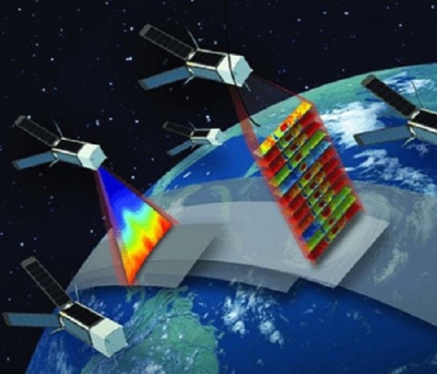
Yet, despite all that is known about atmospheric rivers, forecasting their development and evolution can be a challenge, as they tend to form and propagate over the ocean where in situ and even airborne observations are limited. Weather satellites can help expand coverage of these areas, but even their instruments can be stymied by thick clouds and heavy precipitation. Therefore, if the scientific community’s forecasting of atmospheric rivers is to improve, so too must the methodologies and observations used to predict them.
Among the scientists working to make these improvements a reality is Dr. Anna Wilson, Field Research Manager at the Scripps Institution of Oceanography’s Center for Western Weather and Water Extremes. Located at the University of California–San Diego, the Center’s mission is to provide the latest science and technology to address the effects of extreme weather on the environment, population, infrastructure, and economy of Western North America. It is here that Wilson and her colleagues conduct research to enhance the observation, understanding, and prediction of extreme weather events, including atmospheric rivers and other phenomena, in the region.
“My current work focuses on identifying monitoring gaps to support operational numerical weather prediction needs, both for situational awareness and for assimilation into model runs,” said Wilson. “It also focuses on improving understanding of physical processes that are essential to accurately predict hazards that impact life and property.”
In addition to her work with the Center for Western Weather and Water Extremes, Wilson is also a member of the User Working Group (UWG) of NASA’s Global Hydrometeorology Resource Center Distributed Active Archive Center’s (GHRC DAAC). A joint venture of NASA's Marshall Space Flight Center and the University of Alabama–Huntsville’s Information Technology and Systems Center, GHRC DAAC ingests, processes, archives, and distributes satellite, airborne, and in-situ data products pertaining to lightning, tropical cyclones, and storm-induced hazards in NASA’s Earth Observing System Data and Information System (EOSDIS) collection. These data are crucial to the investigation, characterization, and monitoring of hazardous weather and the dynamical and physical processes that govern it.

Of particular interest to Wilson and her colleagues are the data from NASA’s Global Precipitation Measurement (GPM) Core Observatory and Tropical Rainfall Measuring Mission (TRMM) satellites archived at the GHRC DAAC. According to Wilson, these data are “incredibly valuable,” because they allow for more high-resolution observations of precipitation processes in the mid-latitudes, where atmospheric rivers form. She also cited the benefit of data collected during air and ground campaigns, such as the GPM Ground Validation Program and the Olympic Mountain Experiment (OLYMPEX) field campaign, given that the high-resolution spatial and temporal data they provide are useful for “delving into case studies and enhancing process-level understanding.”
As a case in point, Wilson and her colleagues from the Center for Western Weather and Water Extremes, the National Oceanic and Atmospheric Administration’s National Centers for Environmental Prediction, and the Department of Atmospheric and Oceanic Sciences, University of Colorado–Boulder, demonstrated the significance of airborne data in 2021 study, “Data Gaps within Atmospheric Rivers over the Northeastern Pacific,” conducted to examine the effectiveness of using data from a targeted field campaign (known as AR Reconnaissance) to fill gaps in observations of atmospheric rivers in the northeastern Pacific.
As Wilson and her coauthors note, satellite radiances can provide data within the atmospheric river object, but their quality is “degraded” near the atmospheric river core and leading edge, due to the existence of thick clouds and precipitation. In addition, when airborne data are excluded from analysis, “there is a gap in atmospheric river regions from near the surface to the middle troposphere (below 450 hPa), where most water vapor and its transport are concentrated.” [Note: hPa is an abbreviation for Hectopascal Pressure Unit, which is the international unit for measuring atmospheric or barometric pressure.]
Wilson and her colleagues do not contend that, in the context of atmospheric rivers, satellite observations are to be abandoned in favor of data from air campaigns. Rather, as Wilson and her fellow authors note, both data sources are necessary for comprehensive atmospheric river observations.

“Despite the apparently extensive swaths of modern satellite radiances, which are critical to estimate large-scale flow, the data collected during 15 AR Reconnaissance cases in 2016, 2018, and 2019 supply about 99 percent of humidity, 78 percent of temperature, and 45 percent of wind observations in the critical maximum water vapor transport layer from the ocean surface to 700 hPa in atmospheric rivers.”
Further, using these observations in concert can enhance the accuracy of both weather forecasts and models, Wilson said.
“Airborne reconnaissance observations targeted at specific storms over the oceans are an essential complement to satellites to capture features of the low-level jet and other phenomena associated with atmospheric rivers. These observations can help to increase forecast accuracy by better constraining model initial conditions.”
In another coauthored study published in 2017, GPM Satellite Radar Measurements of Precipitation and Freezing Level in Atmospheric Rivers: Comparison with Ground-Based Radars and Reanalyses, Wilson and her colleagues sought to compare measurements of atmospheric river precipitation rates, microphysical processes, and freezing level height from the GPM satellite’s Dual-Frequency Precipitation Radar (DPR) with in-situ observations and model re-analyses of precipitation data during the winter seasons of 2014 through 2017.
The GPM satellite’s DPR instrument monitors global precipitation parameters between 65°N and 65°S latitude, including precipitation rate estimation, snow versus rain discrimination, freezing level height estimation, and discernment of convective versus stratiform precipitation types. The instrument consists of a Ku-band Precipitation Radar (the KuPR is an updated version of the unit flown on the TRMM satellite) and a Ka-band Precipitation Radar (KaPR), which allow it to provide 3-D measurements of the shapes and sizes of raindrops and snowflakes and other characteristics to help scientists better understand the physical properties of storms.
Wilson and her colleagues found that, although the GPM-DPR did not effectively reproduce the observed spatial patterns of precipitation accumulation over the western United States, it did provide accurate and independent measurement of atmospheric river freezing level height, which is a key factor in determining precipitation impacts on landfall.
These findings are significant for, in the words of the study’s authors, “advancing understanding of precipitation processes in the eastern North Pacific Ocean requires improved observations.” Therefore, despite its limitations, GPM-DPR data can still contribute to that understanding.

“Diagnosing inconsistencies between satellite measurements and reanalyses lends perspective to precipitation and temperature biases in global models. This is necessary for interpreting model-based estimates of future atmospheric river characteristics and impacts, reducing uncertainty in numerical weather prediction forecasts, and constraining simulated global moisture and energy budgets,” the authors write. “Although GPM-DPR exhibited several important limitations, chiefly related to sampling frequency and minimum reflectivity sensitivity, it is clear that the advanced satellite product yields tremendous benefit for reducing the data gap over the global oceans and supplementing current understanding of precipitation processes in atmospheric rivers.”
As the conclusions of this and the previous (2021) study suggest, NASA [Earth-observation] data plays a critical role in helping Wilson and her colleagues address some of the open research questions in their field.
“NASA Earth science data are critical in advancing our understanding of Earth system science,” said Wilson. “Their foundational, consistent space- and ground-based observations provide our baseline understanding, are crucial inputs for global operational numerical weather prediction models, and they allow for breakthroughs in difficult science questions.”
Representative Data Products Used or Created:
Available through GHRC DAAC:
- GPM Ground Validation Special Sensor Microwave Imager/Sounder (SSMI/S) LPVEx dataset
doi:10.5067/GPMGV/LPVEX/SSMIS/DATA101 - RSS SSM/I OCEAN PRODUCT GRIDS DAILY FROM DMSP F15 doi:10.5067/MEASURES/DMSP-F15/SSMI/DATA301
- TRMM Cyclone Precipitation Feature (TCPF) Database - Level 1
doi:10.5067/TRMM/TCPF-L1/DATA201 - GPM DPR Precipitation Profile L2A 1.5 hours 5 km V06 (GES DISC)
doi:10.5067/GPM/DPR/GPM/2A/06 - PRISM Climate Data (Oregon State University)
https://prism.oregonstate.edu/
Other data products used:
- ERA-5 (European Centre for Medium-range Weather Forecasting)
https://www.ecmwf.int/en/forecasts/dataset/ecmwf-reanalysis-v5 - MERRA2 3-Hourly Assimilated Meteorological Fields doi:10.5067/WWQSXQ8IVFW8
Read about the Research:
Zheng, M., Delle Monache, L., Wu, X., Ralph, F.M., Cornuelle, B., Tallapragada, V., Haase, J., Wilson, A.M., Mazloff, M., Subramanian, A., & Cannon, F. (2021). Data gaps within atmospheric rivers over the northeastern Pacific. Bulletin of the American Meteorological Society, 102(3), E492–E524. doi:10.1175/BAMS-D-19-0287.1
Cannon, F., Ralph, F.M., Wilson, A.M., & Lettenmaier, D.P. (2017). GPM satellite radar measurements of precipitation and freezing level in atmospheric rivers: Comparison with ground-based radars and reanalyses. Journal of Geophysical Research: Atmospheres, 122(12): 747-12,764. doi:10.1002/2017JD027355