Although cloud reflective properties and their effects on the global radiation balance have long captivated scientific interest, atmospheric aerosols are less well-studied. Like clouds, atmospheric aerosols cool the atmosphere by reflecting sunlight back into space (direct radiative forcing). Aerosols also modify cloud reflective properties (indirect radiative forcing). But because the amounts and effects of atmospheric aerosols are still not well known, climate models are unable to accurately estimate surface temperatures.
Cooling caused by indirect and direct atmospheric aerosol radiative forcing may be substantial. Consider: biomass burning in the tropics releases an estimated 114 teragrams (Tg)—more than 125 million tons—of smoke each year, to say nothing of annually generated aerosols from forest fires, dust storms and volcano eruptions. On a planetary scale, atmospheric aerosols' cooling effects may compete and offset global warming caused by greenhouse gases, according to Sundar Christopher, assistant professor at the South Dakota School of Mines and Technology.
"How much solar radiation are atmospheric aerosols reflecting back into space? That is the key question," said Christopher. In 1996, with colleagues working at the Institute of Atmospheric Sciences at the School, Christopher used two satellite data sets to arrive at the first estimates of radiative forcing of atmospheric aerosols from biomass burning using satellite data. In the process, the team developed a new technique for discerning aerosols in satellite imagery.
"Biomass burning is particularly important because between June through October of every year in the Southern Hemisphere, and December to April in the Northern Hemisphere, a lot of burning takes place, and the effects of these events on the radiation budget are relatively unexplored," Christopher said.
However, in order to examine the radiative effects of smoke, the researchers first had to identify it in the satellite imagery. The task is similar to that of studying satellite pictures of the poles, Christopher explains. "The background is very, very bright in the arctic regions. Clouds above a background of snow or ice are hard to spot. In the biomass burning regions, the background is also sometimes very, very bright, and you can't tell if there are thin hazy aerosols over a particular layer."
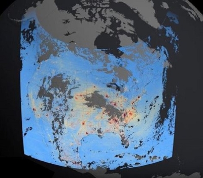
"Most of the work to date has examined only spectral information, the differences between instrument channels," Christopher said. The researchers compared data from two sensors, the Advanced Very High Resolution Radiometer (AVHRR) and Earth Radiation Budget Experiment (ERBE) scanner, both flown on the NOAA 9 satellite, and used spectral information with textural information to see the smoke in 13 images of South America over two biomass burning seasons. "One of the main advantages to using these data was the collocation in time and space. Since the instruments are on the same satellite, then ERBE and AVHRR are looking at the same real estate," he said.
Comparing images from separate AVHRR instrument channels, one susceptible to aerosol loading and the other responsive to the height of the aerosols, gave the researchers a spectral difference. With three-band overlays, even thin aerosols could be seen. The team then subjected the composites to elaborate statistical measurements of the spatial distributions of gray levels in each satellite image.
"The information we're tapping is not only spectral information, but spatial information, that is, textures," Christopher explained. "Our goal was to move from a visual perspective to an automated one," he said, "so that given an image, (the computer) could automatically tell us which pixel is smoke, which pixel is fire, which pixel is land, which pixel is cloud. At this point, it's not completely automated. With textural information you have to calculate things spatially, so it's a computational burden.
"After locating a biomass burning plume in AVHRR data, we overlaid precisely the footprint of ERBE and it gave us the top of atmosphere flux from this biomass burning, then we could find out the top of atmosphere flux for a clear sky area. By differencing the two, we calculated the radiative forcing of the aerosols in the area of burn."
The team estimated instantaneous radiative forcing for 11 images. "We found that cooling is about minus 36 watts per meter squared," Christopher said. "This value has not been averaged over time. This is just when the satellite passed over each particular area in these images," he said. "Modeling studies are also coming up with values on the order of minus 25 to 40 watts per meter squared for instantaneous radiative forcing. So it's good to know that ERBE is picking up the right magnitudes."
Deriving global estimations of radiative forcing, and studying radiative forcing as a function of different ecosystems are important horizons in his work plans, he said, and reason for looking forward to the 1997 launch of the TRMM platform, which will carry instruments similar to the AVHRR and ERBE scanner. "The Earth is going to be sampled more than one time in a particular day," he said, "that will allow me not only to do instantaneous radiative forcing, but time-averaged global radiative forcing, so I anticipate a much better look at some of those signatures."
References
Christopher, S. A., D. V. Kliche, J. Chou, and R. M. Welch. 1996. First estimates of the radiative forcing of aerosols generated from biomass burning using satellite data. Journal of Geophysical Research. 101(D16):21,265-21,273.
For more information
NASA Atmospheric Science Data Center (ASDC)
Advanced Very High Resolution Radiometer (AVHRR)
Earth Radiation Budget Experiment (ERBE)
| About the remote sensing data used | ||
|---|---|---|
| Sensor | Advanced Very High Resolution Radiometer (AVHRR) Earth Radiation Budget Experiment (ERBE) |
|
| Parameter | atmospheric aerosols | |
| DAAC | NASA Atmospheric Science Data Center (ASDC) | |