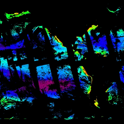
The launch and successful operation of the Earth Resources Satellite-1 Synthetic Aperture Radar (ERS-1 SAR) over the past two years has lead to development of several important new techniques for topographers. Notable among these techniques is interferometry—a process which combines SAR information from two or more passes of the satellite over the same location to yield surface height and/or displacement estimates. Radar interferometry from satellites is now gaining attention as a technique to rapidly acquire accurate topographic data, especially in remote areas of the globe that are useful in digital elevation models.
This report provides a concise summary of the theory behind radar satellite interferometry and the uncertainties of such measurements. It continues with an analysis of the use of ERS-1 data collected within the Alaska SAR Facility (ASF), University of Alaska Fairbanks station mask. Five sites, exemplifying varying terrain, were imaged and topographic estimates constructed. Digital elevation models (DEMs) computed from these image pairs were found to be within 10-20 m accuracy of known elevations. When ground control points were factored into the computation, the accuracy was on the order of 2 m. Techniques for production of such DEMs is straightforward, in fact this study used standard SAR products from the ASF Facility.
The main deterrents to production of accurate topographic mapping from ERS-1 SAR data include uncertainties due to accuracy in the location of the satellite sensor, and decorrelation of the surface signal due to surface changes caused primarily by the time between satellite observations which can be from days to months. The authors conclude that topographic maps with relative errors of 5 m rms or less can be derived from such interferometric techniques, providing a relatively cheap and expeditious method for generation of regional scale DEMs. However, problems with the positional accuracy of the current ERS-1 satellite, and large temporal gaps between image acquisition exclude the development of a global topographic database which is better than those currently available. Furthermore, it is unlikely that highly accurate global topographic mapping is possible, even with placement of global positioning system equipment aboard a future ERS-1 class satellite.
References
Zebker, H. A., C. L. Werner, P. A. Rosen, and S. Hensley. 1994. IEEE Transactions on Geoscience and Remote Sensing. 32(4):823-836.
For more information
NASA Alaska Satellite Facility Distributed Active Archive Center (ASF DAAC)
| About the remote sensing data used | ||
|---|---|---|
| Data | European Remote Sensing Satellite (ERS-1) | |
| Parameter | radar satellite interferometry | |
| DAAC | NASA Alaska Satellite Facility Distributed Active Archive Center (ASF DAAC) | |