Have you ever put together a jigsaw puzzle only to discover you were missing some pieces? The picture just doesn't look quite right. This is the scenario that scientists sometimes face when trying to create a picture of what the Earth's future climate will look like. The climate puzzle may look almost complete, but there is a piece missing--and it's a vital one.
Climate models use mathematical equations to simulate how the Earth's climate, both past and future, responds to changes in levels of greenhouse gases, aerosols, and solar energy. Since they take into account factors such as the size of the Earth, the shape and elevation of continents, the composition of the atmosphere, atmospheric and oceanic circulation, and the amount of sunlight striking the Earth, climate models can create "artificial" climates that mathematically resemble the real world.
Researchers rely increasingly on climate models to explore the Earth's climate system. But according to a recent Intergovernmental Panel on Climate Change (IPCC) report, one of the biggest challenges in building a reliable climate model is representing the effects of clouds, particularly the way they reflect sunlight and emit thermal energy.

"Traditional climate models have a rather simple view of clouds and their effects on climate, partly because the models can't duplicate the wide range of cloud processes," said Norman Loeb, a professor at Hampton University and research scientist at the Langley Research Center (LaRC).
Clouds play an important role in climate, not only because they produce precipitation, but also because they help regulate the Earth's radiation balance, where the energy absorbed from the sun must equal the energy radiated back into space. By reflecting incoming sunlight and blocking the flow of radiation from the surface back to space, clouds play a pivotal role in a delicate balance that sets the temperature on Earth.
Without this balance, the Earth's average temperature would increase or decrease, so a change in cloud cover can ultimately influence climate. "Cloud properties change over time, and understanding how these changes affect the Earth's radiation is critical for improving model predictions of future climate," said Loeb, who studies cloud properties and devotes much of his current research efforts to developing satellite-based global climate data that will improve the way cloud effects are represented in climate models.
Since scattered radiant energy, or light, helps control the Earth's energy balance, accurate measurements are essential to long-term climate change studies. Satellite data enable scientists to study the Earth's atmosphere from space, a perspective that renders the effects of scattered light more noticeable. According to Loeb, the path that light travels is very different if you observe an object from a straight, downward view than if you observe it from an oblique view, where light scatters through a longer path. When you look straight up at the sky, for example, its color is increasingly blue, but it fades to white as you look toward the horizon where light scatters through a longer path.
Looking down at a body of water (while flying, for example) also illustrates how perspective can influence the path that light travels. If you face the sun when the sky is cloud-free, light reflected from the water is very bright, but when the sun is behind you, the reflection appears darker. In contrast, if a thick cloud layer covers the water, the light appears more uniform in all directions. "Because we don't live in space, visually speaking, we tend to have a very surface-dependent view of the world," said Loeb.

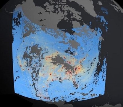
To accurately represent the radiative flux from clouds, or how much the radiance is distributed in different directions within a given area, Loeb needed data from a satellite sensor that measured radiance in several directions. The Clouds and the Earth's Radiant Energy System (CERES) instrument, which flies aboard NASA's Tropical Rainfall Measuring Mission (TRMM), Terra, and Aqua satellites, was designed to measure radiation escaping from the Earth to deep space.
But even though CERES scans the Earth at many different angles, a single satellite cannot measure all of the light reflected and emitted from all directions at the same instant in time. This would require thousands of satellites, which is just not feasible. To compensate for the lack of measurements, Loeb built angular distribution models, or models that account for the various angles at which light travels through clouds. The models incorporate more than a billion CERES radiance observations from NASA's Atmospheric Sciences Data Center (ASDC) which archives and distributes the data.
"Because the angle and path through which light travels varies, models must be tied to specific areas, or 'scenes,' on the Earth that have similar properties, such as clear ocean, thick and thin clouds, or water and ice clouds," said Loeb. To accomplish this, he combined the CERES radiance data with observations from the Moderate Resolution Imaging Spectroradiometer (MODIS) instrument, which also flies aboard NASA's Terra satellite. Since MODIS can view features on the Earth as small as 250 meters, the instrument's data helped Loeb identify different scenes, which significantly improves the accuracy of the angular distribution models.
But the puzzle wasn't complete yet. Clouds are often represented in climate models as one-dimensional features that exhibit the same properties in all locations. In the real world, however, clouds are three-dimensional features with different, complex behavior. Clouds also vary significantly by location, time of day, changing weather, and season. The tropics, for example, typically have more clouds than other latitudes, and clouds there also tend to be one to two kilometers higher than in midlatitude regions.
For the first time, Loeb's new angular distribution models enable researchers to look at different cloud types (such as convective, stratus, stratocumulus, and cumulus) with sufficient accuracy and clarity to detect subtle, but crucial, climate signals caused by clouds. Kuan-Man Xu, also a research scientist at ASDC and one of Loeb's colleagues, is using this breakthrough to develop new ways of using satellite data to test different cloud types in climate models.
"Scientists can easily alter the characteristics of a few clouds in climate models, but to do so for hundreds of thousands of clouds would be much more difficult," said Xu. Grouping clouds into distinct systems allows Xu to describe a large number of clouds, while significantly reducing the amount of time required to enter the information into climate models. "The ability to explain variations in cloud properties in different geographic locations is key to further evaluating the performance of cloud models," he said.
In the future, Xu plans to analyze more data to look at how cloud types are influenced by meteorological conditions, such as temperature and humidity. "Improved cloud models significantly improve the accuracy of global climate models, which can lead to more accurate predictions of climate change," said Xu.
By learning more about cloud properties and how to accurately represent them in models, Loeb and Xu are one step closer to filling in the missing piece of the climate puzzle.
References
Houghton, J. T., Y. Ding, D .J. Griggs, M. Noguer, P. J. van der Linden, and D. Xiaosu, editors. 2001. Contribution of Working Group I to the third assessment report of the Intergovernmental Panel on Climate Change (IPCC). United Kingdom: Cambridge University Press.
Loeb, N. et al. 2002. Angular distribution models for top-of-atmosphere radiative flux estimation from the Clouds and the Earth's Radiant Energy System instrument on the Tropical Rainfall Measuring Mission satellite. Part 1: Methodology. Journal of Applied Meteorology 42: 240-265.
Schmidt, L. 2001. Clouds in the balance. Distributed Active Archive Center Alliance: Supporting Earth Observing Science 2000/2001.
Smith, C. 1998. Shadows of doubt: modeling cloud effects. Distributed Active Archive Center Alliance: Supporting Earth Observing Science 1998.
Xu, K. 2004. Cloud object modeling and observations for climate studies. 14th International Conference on Clouds and Precipitation-ICCP2004, 18-23 July 2004, Bologna, Italy, International Commission on Clouds and Precipitation (ICCP).
Xu, K.-M., T. Wong, L. Parker, B. A. Wielicki, D. A. Randall, M. Branson, D. H. Wang, and B. Barkstrom. 2002. Study of large ensemble of cloud systems from EOS satellite observations for cloud model evaluation. 13th Symposium on Global Change and Climate Variations, 13-17, January 2002, Orlando, Florida, American Meteorological Society, 162-164.
For more information
NASA Atmospheric Science Data Center (ASDC)
Clouds and the Earth's Radiant Energy System (CERES)
International Satellite Cloud Climatology Project (ISCCP)
| About the remote sensing data used | ||
|---|---|---|
| Satellite | Tropical Rainfall Measuring Mission (TRMM) | |
| Sensor | Clouds and the Earth's Radiant Energy System (CERES) | |
| Parameter | cloud cover and climate | |
| DAAC | NASA Atmospheric Science Data Center (ASDC) | |