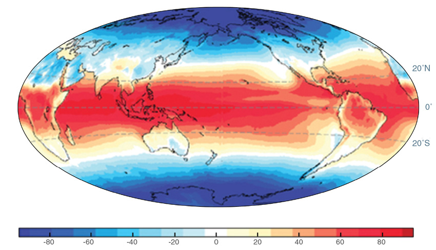
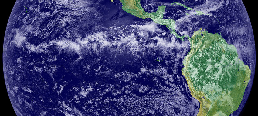
When viewed from space, the tropics are often obscured by a loosely swirling band of clouds meandering around the equator. The recipe that forms this band is fairly simple: Hot tropical air rises, water vapor in the heated air forms clouds, and the water often precipitates out as rain. But rain does not fall evenly across the tropics. “It’s clear from any map of precipitation that it rains more in the Northern Hemisphere than in the Southern Hemisphere,” said Dargan Frierson, a professor at the University of Washington.
Because heat drives rainfall, Frierson was perplexed: Where was this hemispheric heat imbalance coming from? And will climate change push that rain even further north, bypassing some of the globe’s critical rice and tea croplands?
Atmosphere or ocean heating?
This swath of rain forms along the equator where the trade winds converge and steer tropical storms. It tends to govern the tropical climate, creating wet and dry seasons rather than cold winter and hot summer seasons. Frierson became curious about what heat source could pull those rain bands north on such a large scale. Some scientists speculated that the northwest-to-southeast tilt of the ocean basins in the tropics draws heat and rain north. They also thought the fact that there is more land in the Northern Hemisphere than the Southern Hemisphere might be responsible. To test this, Frierson created computer models simulating an Earth without landmasses, called aquaplanet models. On an ocean-covered Earth, with no landmasses to interfere with oceanic or atmospheric circulation, one might think that precipitation would be more uniformly distributed. But that was not the case. “We found that in the aquaplanet model, heating is still plenty strong enough to move the rain band into the Northern Hemisphere,” Frierson said.
This meant neither landmass asymmetry nor tilting ocean basins was the culprit. Some other process must heat the Northern Hemisphere on a large enough scale to tug tropical rainfall north. “It really matters which hemisphere is heated more,” he said. When he delved into the dilemma, he had two suspects: heating at the top of the atmosphere from radiation, or heat in the oceans.
First, he and his colleagues looked at energy from radiation. The Earth is heated by the sun, and is cooled by outgoing longwave radiation. Data from two of NASA's Clouds and the Earth’s Radiant Energy System (CERES) instruments, flying on NASA's Aqua and Terra satellites, along with data from NASA's Solar Radiation and Climate Experiment (SORCE) satellite and other sources, allowed the researchers to calculate incoming solar radiation, while subtracting longwave radiation, as well as radiation reflected out by geographical features like ice and deserts. This gave them the total radiation for each hemisphere.
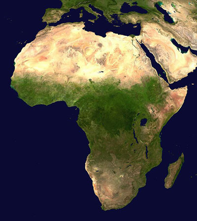
It turns out both hemispheres receive the same amount of solar radiation. So for top-of-atmosphere heating to be the culprit, then the Northern Hemisphere would have to retain more of the incoming solar radiation or emit less longwave radiation. Yet that was not the case. “We were really surprised,” Frierson said. “The Sahara and Arabian deserts in the Northern Hemisphere reflect away a lot of solar radiation. This ultimately leads to the Southern Hemisphere retaining more radiation.”
The results buoyed their theory that if radiation was not pulling tropical rain bands north, heat in the oceans was the likely source. “The CERES data was really the key piece of the puzzle,” Frierson said. “Honestly, it was one of the coolest times of my scientific career: downloading that data, doing that calculation, and seeing that answer. It helped us confirm that radiation was not the driver, so we had more confidence that it must be the ocean.”
Salty, sinking water
But how do oceans influence rainfall patterns? Oceans store and transport heat through currents that work much like giant conveyor belts. Global temperature differences help stimulate this circulation. Solar radiation is most intense along the equator, and gradually decreases at higher latitudes. “The fact that higher latitudes get less sunlight than lower latitudes is the fundamental driver of oceanic and atmospheric circulations,” said Yen-Ting Hwang, who studies ocean heating and circulation.
Another key factor in ocean circulation is salt. Salt water is denser than fresh water, and therefore sinks. Cold water is denser than warm water, and likewise sinks. Consequently, fresh, warm water remains near the surface and salty, cold water sinks into the deep ocean. This produces the continual churning and movement that form a large set of the world’s ocean currents, called the Meridional Overturning Circulation.
Frierson and his colleagues focused on a giant, continuous loop in the Atlantic that transports warm water from the tropics to the poles, traveling all the way from Antarctica to Greenland. At the poles, sea ice squeezes salt out of water as it freezes, leaving even saltier water. “Salty and cold water sinks in North Atlantic high latitudes. The dense water travels in the deep ocean and most of it upwells in the Southern Ocean,” Hwang said. “The overturning circulation in Atlantic constantly brings warmer water from Southern Hemisphere to the Northern Hemisphere and brings colder, denser water away from the Northern Hemisphere.” While landmasses may not directly contribute to hemispheric warming, they do affect ocean circulation. Hwang said, “The way that the continents are set up makes the Atlantic saltier than the Pacific, which is a key driver of the Meridional Overturning Circulation.”
When the researchers modeled ocean heating, they confirmed that temperature overturning was creating a warmer North Atlantic. “Water sinks near Greenland because it’s really cold and salty,” Frierson said. But they also found this warming helped drag the rain bands slightly north of the equator. “The sinking cold water near Greenland just flushes out all the really cold stuff from the North Atlantic,” Frierson said. “So you’re left with warmer water there, and it sort of tugs all the warmth toward that, too.” The ocean releases some of that heat into the atmosphere, which in turn fuels atmospheric heat circulation and pulls more warm air to the north of the equator. That pool of warmer air creates the tug, shifting tropical precipitation slightly north.
Tail wagging the dog
Scientists long thought that the tropics control global climate and weather patterns. But they have since realized that extratropical regions, further from the equator, also influence far-reaching patterns. “We’ve discovered in the last ten years or so that even the high latitudes have big impact on tropical rainfall,” said Frierson. “It was kind of like the tail wagging the dog.” This means that changes in polar climate or sea ice formation could influence where rain falls. “The Meridional Overturning Circulation is very slow—it takes hundreds of years to recirculate,” he said. “But it is something that we expect to change with global warming.”
If the oceanic overturning process that transports heat slows down or changes, more cold water can pool in the North Atlantic, coaxing tropical rain bands south. “We actually started this research with the goal of understanding how the tropical rain belt would change with climate change,” Hwang said. “The tropics are one of the most vulnerable places to climate change. At the boundaries of tropical rain belt, people depend on rainy seasons to grow crops. An anomalous variation in the location of the tropical rain belt results in tremendous changes to local rainfall and affects millions of people.” Most of the world’s rice paddies are located across Southeast Asia, in the northern tropics. Likewise, much of the world’s tea and coffee are produced in countries that lie in the north tropics, such as India and Colombia.
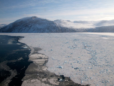
Other changes, such as increasing fresh river runoff from Siberian rivers coupled with decreasing sea ice could create fresher, warmer Arctic waters less likely to fuel overturning in the oceans. Frierson said, “So instead of that cold water being flushed down into the deep ocean, it’s going to instead stay up there.” This would help offset the tendency for tropical rainfall to shift northward with climate change.
“We hear all the time about how the tropics can affect the rest of the world, with El Niño and La Niña, but the extratropics can also affect the tropics,” Frierson said. “I think any kind of study that contributes to how rainfall there is determined and how it might change in the future is really important.”
References
Frierson, D. M. W., Y.-T. Hwang, et al. 2013. Contribution of ocean overturning circulation to tropical rainfall peak in the Northern Hemisphere. Nature Geoscience 6: 940–944, doi:10.1038/NGEO1987.
NASA Atmospheric Science Data Center (ASDC). CERES Energy Balance and Filled Top of the Atmosphere (EBAF-TOA) Ed2.8, Hampton, Virginia, USA.
For more information
NASA Atmospheric Science Data Center (ASDC)
Clouds and Earth’s Radiant Energy System (CERES)
| About the remote sensing data | |||
| Satellites | Terra and Aqua | ||
| Sensor | Clouds and Earth's Radiant Energy System (CERES) | ||
| Data set | CERES Energy Balance and Filled Top of the Atmosphere (EBAF-TOA) Ed2.8 | ||
| Resolution | 1 degree latitude, zonally gridded | ||
| Parameter | Radiant energy flux | ||
| DAAC | NASA Atmospheric Science Data Center (ASDC) | ||
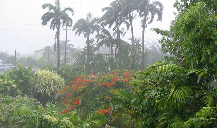
The photograph in the title graphic shows a tropical rainstorm brewing over the Maldives. Rainfall patterns like these are often influenced by global oceanic and atmospheric circulation. (Courtesy M. Taylor, Flickr)
