Dr. Ludovic Brucker, Universities Space Research Association (USRA)/Goddard Earth Sciences Technology And Research (GESTAR) program; Manager and Senior Scientist, Cryospheric Sciences Laboratory, NASA’s Goddard Space Flight Center, Greenbelt, MD
Research interests: Investigating climate-related changes to ice sheets, snow, and sea ice using microwave instrument observations from Earth observing satellites and aircraft coupled with measurements collected during field expeditions.
Research highlights: Prince Charles Island sits just north of the Arctic Circle off the west coast of Baffin Island in the Qikiqtaaluk Region of Nunavut, Canada. While the island was likely known to native Inuit peoples, it is so remote that it did not appear on published maps until the mid-20th Century.
In the summer of 2016, Canadian scientists flying over the island came across a grisly scene—dead caribou, as many as 50, covering the ground. It appeared, according to one scientist, as if the animals had simply dropped where they were standing. The reason for the mass die-off was a mystery. Research by Dr. Ludovic Brucker, in collaboration with colleagues from the University of Sherbrooke in Quebec, helped provide an answer.
Brucker’s research area is the cryosphere, which includes frozen ground, snow, ice sheets and ice shelves, sea ice, glaciers, and river and lake ice. Due to the sensitivity of snow and ice to temperature increases, the cryosphere is an area where indications of climate variability often are first observed.
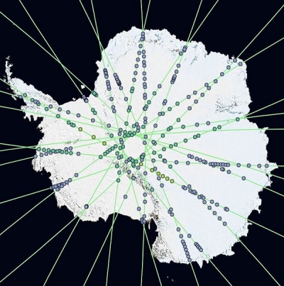
Before the advent of airborne and satellite-borne instruments, the acquisition of cryospheric data required expeditions into some of the most extreme environments on Earth. Vast areas of the Arctic and Antarctic remained unexplored until the 20th Century. Today, data from airborne missions, such as NASA’s Operation IceBridge (operational 2009 to present), and satellite missions, such as NASA’s Ice, Cloud,and land Elevation Satellite (ICESat, 2003 to 2009) and the recently-launched ICESat-2 (2018 to present), are helping to show how a changing global climate is affecting these remote regions.
Brucker uses a combination of satellite data and field investigations for his studies of ice sheets, snow, and sea ice. Remotely-sensed data are a key component of his work developing algorithms used to produce numerous cryospheric data products. Seven data products co-produced by Brucker are available through NASA’s National Snow and Ice Data Center Distributed Active Archive Center (NSIDC DAAC). NSIDC DAAC archives and distributes NASA Earth observing data related to snow and ice processes, particularly interactions among snow, ice, atmosphere, and ocean, in support of research related to global change detection and model validation.
Monitoring snow and ice from space requires sensors that can collect data without the need for outside illumination (such as during the polar winter) and that can collect data through clouds, haze, and other atmospheric obstructions. Microwave radiometers fill these needs by detecting microwaves radiated from Earth without actively sending out a signal (like radar).
One example of an orbital microwave instrument is the Aquarius sensor, which was built by NASA and carried aboard the Argentine-built Satélite de Aplicaciones Científicas (SAC)-D spacecraft (operational 2011 to 2015). While its primary mission was to collect data on global ocean salinity, Brucker and his colleagues were able to use Aquarius data to study the cryosphere and to produce several data products for the NSIDC DAAC.
In order to ensure that data acquired by an instrument aboard an aircraft or satellite are accurately representing ground conditions, they have to be validated. One way to accomplish this is through field campaigns that collect data at ground-level that are compared with remotely-sensed data. Brucker has participated in more than a dozen field campaigns, including polar deployments in both hemispheres. In addition, he led ground-based remote sensing activities in Colorado as part of NASA’s ongoing multi-year Snow Experiment (SnowEx) campaign. The primary objective of SnowEx is to develop algorithms to aid in the remote sensing of seasonal terrestrial snow and gain a better understanding of how much water can be expected as this snow melts in the spring (SnowEx data are available through NSIDC DAAC). This is vital information for regions that depend on snow melt for drinking water and irrigation, such as the western U.S.
Combining ground-based meteorological data with microwave satellite data helped solve the riddle of the caribou deaths on Prince Charles Island: The deaths were a matter of bad timing.
While early-winter storms can lead to a crust on the ground that can prevent access to forage, caribou generally have the energy reserves at this time to move to other locations to feed. During the winter of 2015 and 2016, however, meteorological data indicate that major storms occurred in April—late in the season and a time when caribou energy reserves are generally at their lowest. Wind and snow from these storms created an unusually dense snowpack, which could be detected by orbiting microwave sensors. Using meteorological and satellite data, Brucker and his colleagues determined that the caribou starved to death when they were unable to break through the dense snow and ice layer to reach the nourishment they needed.
Brucker continues to explore the impacts of a changing climate on the cryosphere, and is preparing for another season of field work, including a campaign to the Canadian High Arctic Research Station in Cambridge Bay, Nunavut. The riddles remain, but the combination of remotely-sensed data and field observations are helping Brucker and his colleagues remove some of the mysteries from these remote regions.
Data products co-produced by Brucker. All are available through NSIDC DAAC:
- SnowEx17 data products:
- Roy, A., Langlois, A. & Brucker, L. (2019). SnowEx17 Radiometrics Surface-Based Radiometer Brightness Temperatures (doi:10.5067/JWONK1ZTSBXX).
- Brucker, L., Hiemstra, C., Marshall, H. & Elder, K. (2018). SnowEx17 Community Snow Depth Probe Measurements (doi:10.5067/WKC6VFMT7JTF).
- Elder, K., Brucker, L., Hiemstra, C. & Marshall, H. (2018). SnowEx17 Community Snow Pit Measurements (doi:10.5067/Q0310G1XULZS).
- Aquarius data products:
- Roy, A., Brucker, L., Prince, M., Royer, A. & Derksen, C. (2018). Level 3 Weekly Polar-Gridded Landscape Freeze/Thaw (doi:10.5067/OV4R18NL3BQR).
- Brucker, L., Dinnat, E. & Koenig, L. (2015):
- Aquarius Level 3 Weekly Polar-Gridded Brightness Temperature and Sea Surface Salinity (doi:10.5067/Aquarius/AQ3_TB.005).
- Aquarius Level 3 Weekly Polar-Gridded Normalized Radar Cross Section (doi:10.5067/Aquarius/AQ3_NRCS.005).
- Aquarius Level 3 Weekly Polar-Gridded Sea Surface Salinity (doi:10.5067/Aquarius/AQ3_SSS.005).
Read about the research:
Dolant, C., Montpetit, B., Langlois, A., Brucker, L., Zolina, O., Johnson, C.A., Royer, A. & Smith, P. (2018). Assessment of the barren ground caribou die‐off during winter 2015–2016 using passive microwave observations. Geophysical Research Letters, 45(10): 4908-4916. doi:10.1029/2017GL076752
Dinnat, E. & Brucker, L. (2017). Improved Sea Ice Fraction Characterization for L-band Observations by the Aquarius Radiometers. IEEE Transactions on Geoscience & Remote Sensing, 55(3): 1285-1304. doi:10.1109/TGRS.2016.2622011
Garcia-Eidell, C., Comiso, J., Dinnat, E. & Brucker, L. (2017). Satellite Observed Salinity Distributions at High Latitudes in the Northern Hemisphere: A Comparison of Four Products. Journal of Geophysical Research: Oceans, 122(9): 7717-7736. doi:10.1002/2017JC013184
Bokhorst, S., Pedersen, S.H., Brucker, L., et al. (2016). Changing Arctic snow cover: a review of recent developments and assessment of future needs for observations, modelling and impacts. Ambio, 45(5): 516-537. doi:10.1007/s13280-016-0770-0
Miège, C., Forster, R., Brucker, L., Koenig, L., Solomon, D.K., Paden, J., Box, J., Burgess, E., Miller, J., McNerney, L., Brautigam, N., Fausto, R. & Gogineni, S.P. (2016). Spatial extent and temporal variability of Greenland firn aquifers detected by ground and airborne radars. Journal of Geophysical Research: Earth Surface, 121(12): 2381-2398. doi:10.1002/2016JF003869
For more information
- Ice, Cloud, and land Elevation Satellite-2 (ICESat-2)
- Operation IceBridge
- Aquarius instrument
- Snow Experiment (SnowEx) campaign