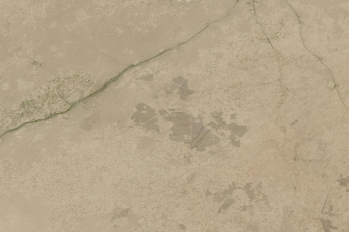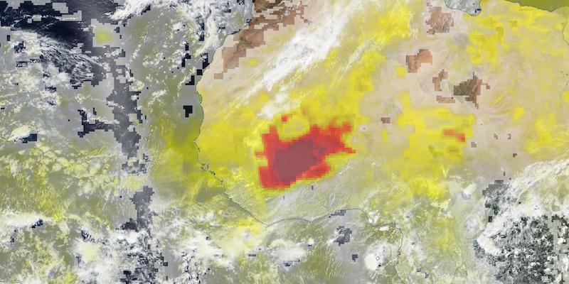
True-color image overlaid with Aerosol Index layer of a dust storm in Burkina Faso. This image was acquired on 2 May 2021 by the Visible Infrared Imaging Radiometer Suite (VIIRS) and the Ozone Mapping and Profiler Suite (OMPS), aboard the NASA/NOAA Suomi National Polar orbiting Partnership (Suomi NPP) satellite. View the images side by side in Worldview and swipe back and forth to see the Aerosol Index layer and the dust in the true color image. Aerosol Index indicates the presence of ultraviolet (UV)-absorbing particles in the air (aerosols) such as desert dust and soot particles in the atmosphere; it is related to both the thickness of the aerosol layer located in the atmosphere and to the height of the layer. The Aerosol Index is a unitless range from < 0.00 to >=5.00, where 5.0 indicates heavy concentrations of aerosols that could reduce visibility or impact human health. The Aerosol Index layer is useful for identifying and tracking the long-range transport of volcanic ash from volcanic eruptions, smoke from wildfires or biomass burning events and dust from desert dust storms, even tracking over clouds and areas of snow and ice.
Visit Worldview to visualize near real-time imagery from NASA's EOSDIS, and check out more Worldview weekly images in our archive.