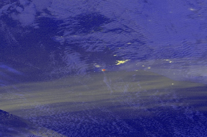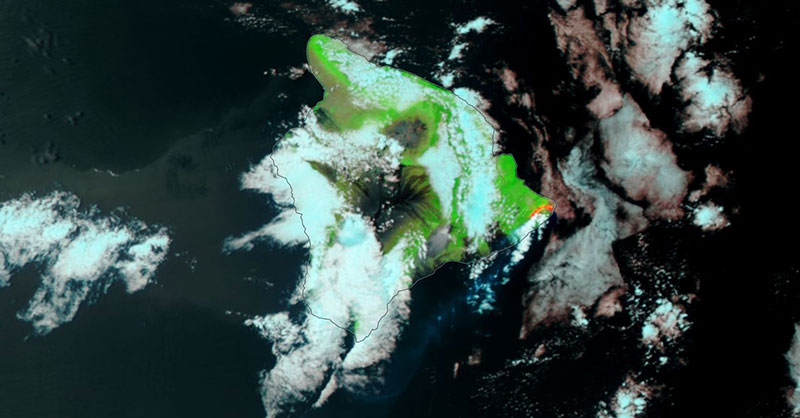
Image of the Big island of Hawaii and the area affected by the Kilauea volcano, visible on the eastern tip, on the 10 June 2018. This false-color corrected reflectance image was captured by the Visible Infrared Imaging Radiometer Suite (VIIRS) aboard the joint NASA/NOAA Suomi National Polar-orbiting Partnership (Suomi NPP) satellite. The false-color image, using VIIRS bands M11-I2-I1, shows the areas burned (in red) as a result of the lava flows on the eastern tip of the island.
Visit Worldview to visualize near real-time (NRT) data from NASA's Earth Observing System Data and Information System (EOSDIS).