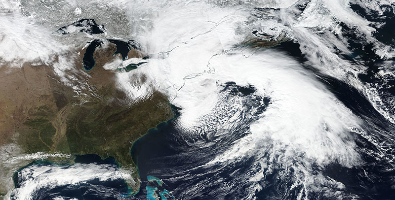
Image of a Nor'easter over the east coast of the USA, acquired on 2 March 2018. The photo-like, true color corrected reflectance image was captured by the Visible Infrared Imaging Radiometer Suite (VIIRS) aboard the joint NASA/NOAA Suomi National Polar-orbiting Partnership (Suomi NPP) satellite.
Visit Worldview to visualize near real-time (NRT) data from NASA's Earth Observing System Data and Information System (EOSDIS).