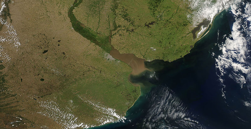
Image of the Rio de la Plata, the river and estuary between Argentina and Uruguay, acquired on 26 November 2017. The photo-like, true color corrected reflectance image was captured by the Moderate Resolution Imaging Spectroradiometer (MODIS) instrument, aboard the Aqua satellite.
Visit Worldview to visualize near real-time (NRT) data from NASA's Earth Observing System Data and Information System (EOSDIS).