Discover FIRMS
Learn how to use FIRMS
- Earthdata Webinar: Discover Enhanced Wildfire System Capabilities with NASA FIRMS (2023)
- Video Tutorial: How to use NASA's Fire Information for Resource Management System (FIRMS) (2022)
- ArcGIS StoryMap: FIRMS: Fire Information for Resource Management System—Managing Wildfires with Satellite Data (2022)
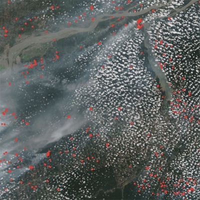
- MODIS Active Fire Products
-
Each MODIS active fire/thermal hotspot location represents the center of a 1km pixel that is flagged by the algorithm as containing one or more fires within the pixel. Combined (Terra and Aqua) MODIS NRT active fire products (MCD14DL) are processed using the standard MOD14/MYD14 Fire and Thermal Anomalies algorithm.
MODIS Collection 61 has been available since April 2021. C61 processing does not contain any change to the science algorithm; the update is from changes and enhancements to the calibration approach used in the generation of the Terra and Aqua MODIS Level 1B products. For further details on C61 calibration changes and other changes user is encouraged to refer to the pdf summarizing Collection 6.1 specific changes. For the most up to date information, please refer to the MODIS Collection 6 and 6.1 Version 1.0 Active Fire Product User's Guide (updated May 2021).
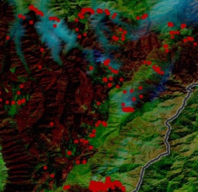
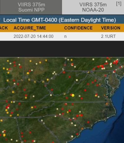
- VIIRS (375m) Active Fire Products
-
Each VIIRS active fire/thermal hotspot location represents the center of a 375m pixel. The VIIRS data complement the MODIS fire detections but the improved spatial resolution of the 375 m data provides a greater response of fires over relatively small areas and has improved nighttime performance. Read more on VIIRS Active Fire products.
VIIRS NRT 375 m active fire products are from: Suomi NPP (VNP14IMGTDL_NRT); NOAA-20, formally known as JPSS-1 (VJ114IMGTDL_NRT); and NOAA-21, formally known as JPSS-2 (VJ214IMGTDL_NRT).
Please note, in an effort to standardize VIIRS file names from Suomi NPP, the short name for VIIRS NRT 375 m product was changed from VNP14IMGT to VNP14IMGTDL_NRT (18 April 2016).
Please note: MODIS and VIIRS active fire/thermal anomaly data may be from fire, hot smoke, agriculture, or other sources.