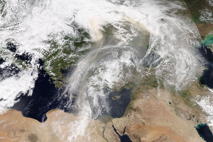
Animation spanning September 17 to 27, 2023, showing high Aerosol Index values associated with continued Canadian wildfires and wildfire smoke over the Atlantic Ocean and approaching western Europe. Press the play button in the lower left corner of the map above to view the animation or click on the icon in the upper right corner of the image to fully interact with the animation in Worldview.
As of September 22, 2023, 6,400 fires have occurred across Canada that have burned 17,577,396 hectares (approximately 43,434,691 acres) so far this year. The number of fires is 120% above the 10-year Canadian average and the amount of burned area is 647% of normal, according to figures from Natural Resources Canada.
The base true-color corrected reflectance images were acquired by the Visible Infrared Imaging Radiometer Suite (VIIRS) aboard the joint NASA/NOAA Suomi National Polar-orbiting Partnership (Suomi NPP) satellite. Overlaid on the base images is the Aerosol Index layer from the Ozone Mapping and Profiler Suite (OMPS) instrument. This layer indicates the presence of ultraviolet (UV)-absorbing particles in the atmosphere (aerosols) such as soot from burning fires and desert dust; it is related to both the thickness of the aerosol layer located in the atmosphere and to the height of the layer.
The Aerosol Index is a unitless value that ranges from < 0 to >= 5, where 5 (indicated by areas of dark red) indicates heavy concentrations of aerosols that could reduce visibility or impact human health, such as dust storms or smoke in the lower troposphere (1-3 km above Earth's surface) from biomass burning.
Visit Worldview to visualize near real-time imagery from NASA's EOSDIS; find more in our Worldview weekly image archive.