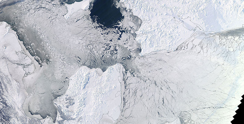
Image of sea ice in the Bering Strait, acquired on 4 February 2018. The photo-like, true color corrected reflectance image was captured by the Moderate Resolution Imaging Spectroradiometer (MODIS) instrument aboard NASA's Terra satellite.
Visit Worldview to visualize near real-time (NRT) data from NASA's Earth Observing System Data and Information System (EOSDIS).