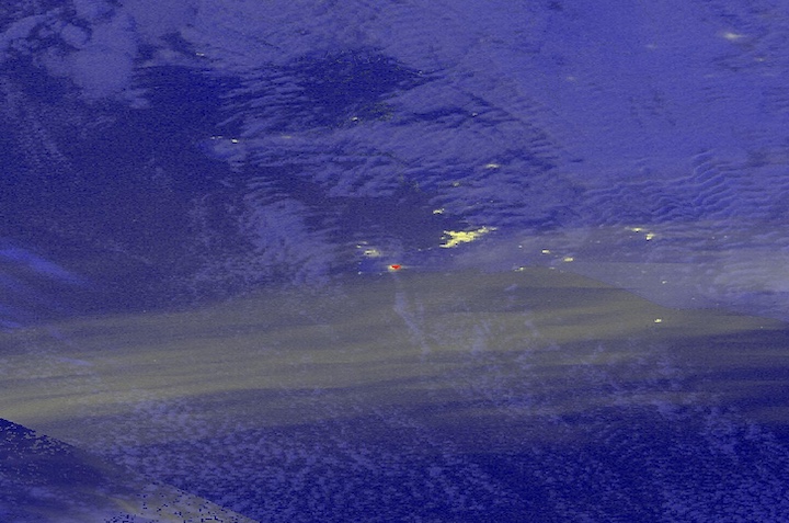
This embedded map shows side by side comparison of a daytime false-color corrected reflectance image of fires and burned area shown in red (left) and a nighttime image with night lights shown in yellow (right) of the Valparaiso region of Chile on February 3, 2024. These images were acquired by the Visible Infrared Imaging Radiometer Suite (VIIRS) aboard the joint NASA/NOAA Suomi National Polar-orbiting Partnership (Suomi NPP) satellite.
Swipe the bar back and forth to see that some of the "night lights" in the right side nighttime image are actually the light emitted from the fires. The image shows that the fires are occurring within close proximity to urbanized areas that are emitting bright city lights.
Visit Worldview to visualize near real-time imagery from NASA's EOSDIS; find more imagery in our Worldview weekly image archive.