The NASA Student Airborne Research Program (SARP) hosted by NASA’s Ames Research Center provides rising senior undergraduate students with opportunities to gain hands-on experience in airborne science. Students participate in an active scientific field campaign and develop individual research projects during the eight-week program with guidance from mentors. The program culminates in a presentation of each student’s research findings.
A major goal of SARP is to educate and inspire students interested in airborne science and broader Earth science fields. SARP invites students to explore a variety of Earth science careers, encouraging them to seek and remain in science career paths. Students participate in professional workshops to build their confidence and skills in communicating about scientific research. They also engage in specialized seminars on a wide variety of airborne science topics such as unmanned aircraft systems and terrestrial remote sensing. Moreover, the student researchers collect air quality data throughout southern and central California. Many projects started in the summer program have provided major contributions to airborne science.

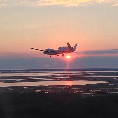
Jillian Ethridge, a metadata curator with the Airborne Data Management Group (ADMG), participated in SARP this summer and shared her experiences with the program. As a student researcher, Jillian had the opportunity to launch several ozonesondes — lightweight, balloon-borne instruments that collect data on ozone — coincident with scientific flights; fly on a NASA research aircraft across much of southern California; attend topic-specific field trips to nature preserves, coastal waters, and locations with interesting atmospheric composition; and collect ocean water samples off the Santa Barbara coast.
For her project, Jillian focused on developing a method to use Geostationary Operational Environmental Satellite (GOES) satellite data to derive water-leaving radiance measurements (ocean color) using a supervised machine learning algorithm called random forest. There are currently no geostationary ocean sensors in the western hemisphere, making it difficult to track coastal hazards such as oil spills or harmful algal blooms. Ocean satellite images are also frequently degraded by cloud obstructions and sun glint. Geostationary satellites such as GOES can mitigate these issues and fill in data gaps by mosaicing together several images taken over a short time period. Through her work, Jillian demonstrated that GOES satellites, which are typically used for atmospheric science applications, can also be used to study the ocean. As these methods are refined, a “world of ocean research can be unlocked in the western hemisphere,” she says. With the upcoming launch of NASA’s geostationary ocean sensor GLIMR (Geosynchronous Littoral Imaging and Monitoring Radiometer) at the end of this decade, the utility of geostationary ocean remote sensing can begin to be tested.

Asked what sparked her interest in the program, Jillian responded:
"I’ve developed an understanding of how NASA airborne campaigns operate and how the data is handled from a data management position, and I was very interested in learning more about airborne data collection during an active campaign."
The program builds connections between peers and mentors, a feature Jillian says was the most valuable part of her experience.
View additional information about SARP.
More information about IMPACT can be found on the NASA Earthdata and IMPACT project website.