Standing on the Earth, we sense it as solid. But beneath us, the abutting plates of Earth’s crust jockey for position; lava squeezes to the surface through rock fissures from molten layers below. Stresses build slowly, silently. Then the destructive shaking of an earthquake or a violent volcanic eruption reminds us that the crust is not static.
People naturally prefer the Earth’s crust to hold still. But some years ago, Kristine Larson, a professor of aerospace engineering, was becoming slightly impatient: she had measurement problems to solve, and needed higher-resolution data on crustal movements. “If the ground is only moving a centimeter per year, you spend a lot of time waiting around to see things,” she said. Larson had been studying plate tectonics, the processes that form and deform the Earth’s crust.

Her work involved measuring movements with Global Positioning System (GPS) receivers, much like the portable versions known for helping wanderers find their way, but mounted firmly to the ground. She thought that by seeking out more dynamic cases to study, she could figure out how to get very precise GPS measurements, minute to minute. This method, called high-rate GPS, is like a time-lapse camera giving scientists a detailed playback of how the crust shakes, shifts, and bulges when plates rupture and lava surges.
Fixing GPS on the problem
The Earth’s crust is like cracked pottery. Pressure in layers below causes these shards to shift at the fracture. Subterranean forces associated with volcanoes can also cause a once-familiar mountaintop to bulge as lava tries to push to the surface. For some time, scientists studying these processes found GPS data to be uniquely helpful. Soon after its introduction for navigation and satellite tracking, GPS was quickly adapted to track the Earth’s crust. NASA helped mount GPS receivers near fault zones and near active volcanoes, where the caldera spews hot ash and lava bombs. Larson said, “You don’t want to send people out to make those measurements.”
Larson, at the University of Colorado at Boulder, specializes in this research-quality GPS, which has a much higher precision than consumer GPS. “You don’t need to know where your car is to a centimeter,” she said. But scientists do want to know about even tiny movements or bulges in Earth’s crust, especially while an earthquake is in progress, or just before and during a volcanic eruption. Without this information, Larson said, “It would be like taking a picture of a vacant lot, then a picture of the finished house. It doesn’t tell you how the house got there.”

For years, researchers could not get these very precise GPS position measurements more than once a day. GPS depends on a constellation of twenty-four satellites orbiting the Earth. A GPS receiver picks up their time- and position stamped signals, and compares data from at least four satellites to compute its own latitude and longitude. But as the satellite signals travel through the atmosphere and are reflected near the GPS receiver, small delays occur, causing “noise” in the data. So data were averaged over a day to smooth out the signal.
Larson thought that she could solve this problem, but she needed data, ideally from something that was moving more often. She became curious about the movements of underground lava. Larson said, “You can look at the gases coming out of the caldera and the lava flowing on the surface. But how do you know where the lava is moving around underneath the earth? How does the lava move around before an eruption?”
Larson started experimenting with data that were already being collected from GPS receivers and stored by NASA's Crustal Dynamics Data Information System (CDDIS). She said, “I was able to use the data for an entirely different purpose than originally intended, because NASA had the foresight to archive it.” Aided by advances in computing and data storage, which helped her work with the large volume of data from frequent measurements, Larson proposed and tested new data-filtering strategies for the GPS-Inferred Positioning System (GIPSY) software, developed by NASA’s Jet Propulsion Laboratory. She was able to separate the data trends from the noise to get more frequent measurements without losing the precision.

A volcano at work
On sabbatical in 1997, Larson traveled to Hawaii’s Kilauea Volcano Observatory to try her solution firsthand on an active volcano, and there worked with Michael Lisowski, a research scientist at the United States Geological Survey (USGS). Researchers watch Kilauea intently for warning signs of a major eruption that could trigger earthquakes, landslides, or a tsunami.
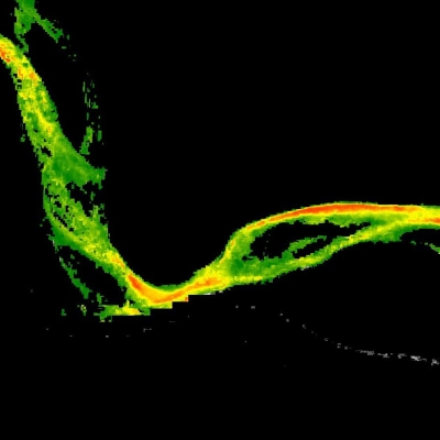
Lisowski studies how the ground deforms around a volcano, a sign of unrest and potential trouble. He said, “As the magma nears the surface, it hits the brittle rock, and then you see what’s going on, as the ground deforms. Deformation measurements help us tell how much material is moving through the crust.” Scientists call this a dike intrusion: magma rises into a fracture in the rock, or forces its way through the rock to create a new crack. As the intrusion and fracturing continues, the volcano widens internally to make room for the magma, causing the surface to deform.
The research team upgraded the existing network of twenty-two GPS receivers to obtain position estimates every fifteen minutes, computed in near-real time. During the study, magma moved under Kilauea’s Pu`u `Ō`ō vent, and the ground deformed thirty-six centimeters (fourteen inches). The study proved the role of high-rate GPS. Lisowski said, “GPS is easy to deploy and is a more stable measurement over a long time period than other instruments, such as seismometers, tiltmeters, and strainmeters.” So scientists would later reach for high-rate GPS during a dike intrusion; meanwhile, Larson wanted to see what else high-rate GPS could reveal.
A dike intrusion can announce itself with the many small earthquakes caused by the fracturing rock. This connection helped lead Larson to the idea for applying high-rate GPS data to earthquakes. She said, “A seismologist explained to me that if you put a seismometer in the middle of an earthquake, especially a big earthquake, it is too sensitive. He thought, wouldn’t it be great if high-rate GPS could work during an earthquake?” Lisowski said, “Early on there were proposals for high-rate earthquake data, such as dragging a GPS receiver behind a truck to measure road lines.” Road line shifts are a clue to earthquake damage (see “When the Earth moved Kashmir,” in this issue, for more on post-earthquake assessment). Larson started work on capturing actual seismic activity with high-rate GPS.

Catching an earthquake
By fall 2002, Larson thought she knew how to capture the shaking during an earthquake. Ready for data, and impatient for an actual earthquake, she planned a static test in a nearby parking lot. Then a magnitude 7.9 earthquake occurred along the Denali Fault in Alaska, and she quickly shifted gears. Larson said, “I trolled on the Web to see if there were any GPS receivers near the Alaska earthquake, and I found one about 100 kilometers (62 miles) away in Fairbanks, and some in British Columbia.” Her search led her to Joan Gomberg, a USGS scientist who studies earthquakes.
Gomberg was also watching the Denali earthquake. She studies earthquake triggering: seismic waves traveling beneath the earth that can set off other earthquakes. Gomberg said, “If you’re a fault sitting there, patiently waiting in the Earth, and a big seismic wave comes and shakes you, then sometimes that will cause you to fail and produce an earthquake. It’s a trigger.” But conventional seismic instruments are not designed to measure these very big waves. Gomberg said, “Because of the mechanics of a seismometer, if you design it to record only the biggest earthquakes, you won’t see anything little, and vice versa. GPS doesn’t go off scale.”
The largest waves of the Denali earthquake lasted only about two minutes. Larson helped Gomberg extract from GPS data the signal of the waves emanating from Denali. Gomberg said, “Denali produced extraordinarily large waves because it is a very long and skinny fault, and it’s all within the crust. And the fault broke from one end to the other.” The rupture continued for 336 kilometers (209 miles) from northwest to southeast, pointing in the direction of the western United States. Gomberg said, “An earthquake is like a crack that grows. If the crack grows in one direction, it focuses all the energy in that direction. This focusing effect was really profound in the Denali earthquake, because it was so long, and started at one end and went in one direction. To understand this triggering process, we want to know, how big were the waves?”
Larson’s high-rate GPS data answered that question. Gomberg said, “The earthquake saturated most of the other instruments; they went off scale. With the high-rate GPS data, you could see as the waves passed by various sites: the earthquakes started going bing bing bing bing bing all the way down western Canada and the United States for thousands of kilometers.”

Reuse, recycle
High-rate GPS opened new avenues for studying earthquakes and volcanoes. From the Denali study, Gomberg said, “We learned the power of this focusing effect. We knew that the waves were phenomenally big due to the way the fault broke, but without GPS, we would never have known how big.” Gomberg thinks these data could lead to greater insights about the processes that cause earthquakes. She said, “Since seismic waves can travel so far, it raises the possibility that you can connect all earthquakes together.”
More recently, high-rate GPS confirmed its place in the volcano study toolbox. Back in Hawaii, when Kilauea’s Pu`u `Ō`ō again stirred in June 2007, researchers quickly deployed temporary GPS arrays, and called on Larson for high-rate GPS data. With an unprecedented combination of satellite and ground data, they saw a frame-by-frame story of a three-phase dike intrusion, accompanied by a slow earthquake that continued over two days, ending in a small eruption. Lisowski said, “GPS has become the major tool for tracking slow deformation, down to minutes. We can now build models that account for the movement of magma and the growth of a dike. These are exciting times, when we can make advances in the understanding of volcanic processes.”
Larson likes that GPS is a widespread technology, keeping costs as low as a few thousand dollars per installation. Larson said, “I know a scientist who uses gravity data. His joke is, ‘If only someone could tell where their car was by putting one of my $350,000 gravity meters on the hood. Then maybe someone else would buy them.’” The economy of scale of GPS, and the ability to reuse data collected for other research, help Larson keep moving on to try it on other elusive geophysical measurements.
References
Gomberg, J., P. Bodin, K. Larson, and H. Dragert. 2004. Earthquake nucleation by transient deformations caused by the M = 7.9 Denali, Alaska, earthquake. Nature 427: 621–624.
Larson, K., P. Bodin and J. Gomberg. 2003. Using 1-Hz GPS data to measure deformations caused by the Denali fault earthquake. Science 300: 1421–1424.
Larson, K. M., P. Cervelli, M. Lisowski, A. Miklius, P. Segall, and S. Owen. 2001. Volcano monitoring using the Global Positioning System: Filtering strategies. Journal of Geophysical Research 106: 1–12.
Sandwell, D., D. Myer, R. Mellors, M. Shimada, B. Brooks, and J. Foster. 2007. Accuracy and resolution of ALOS Interferometry: Vector deformation maps of the Father's Day intrusion at Kilauea. IEEE Transactions on Geoscience and Remote Sensing , doi:https://ieeexplore.ieee.org/document/4685934.
For more information
NASA Crustal Dynamics Data and Information System (CDDIS)
U.S. Geological Survey. Rupture in South-Central Alaska -The Denali Fault earthquake of 2002
U.S. Geological Survey. Using the Global Positioning System (GPS) to measure volcano deformation
| About the remote sensing data | ||
|---|---|---|
| Satellite | Global Positioning System (GPS) | |
| Sensor | GPS Receivers | |
| Data set | GPS Data Archive | |
| Resolution | 1 second | |
| Parameters | Latitude and longitude | |
| DAAC | NASA Crustal Dynamics Data and Information System (CDDIS) | |